20 produkter
20 produkter


20 produkter
Belgium & Luxembourg
Ordinær pris 169,00 krMarco Polo er svært detaljerte kart som er praktiske og enkle i bruk. 7 klistremerker for å markere spesifikke steder gjør det enda enklere å planlegge reisen. Alle kartene inneholder en omfattende index for enkelt å finne frem.
Belgium with Luxembourg at 1:300,000 on a road map from Marco Polo Travel Publishing with prominent highlighting of interesting locations, enlargements for the environs of Brussels, Antwerp, Bruges, Ghent, Liège and Luxembourg City, plus an index booklet with town centre plans of these cities and brief descriptions of 15 selected top sights, etc. Coverage includes Netherlands south of the Meuse/Maas, and within France extends south-west to Compiège and Soissons.
Cartography is from the renowned German publishers MairDumont. Road network includes minor roads, highlights scenic roads and shows intermediate driving distances on main roads. Railway lines and local airports are included, as well as administrative divisions with names of the provinces. Locations of interest are highlighted, with separate colouring for towns or villages and for natural sites; 15 most interesting sights are cross-referenced to their descriptions in a booklet attached to the map cover. Symbols show locations of campsites, youth hostels, etc. National parks and other protected areas are marked and topography is presented by relief shading. The map has no geographical coordinates. The index listing locations with their postcodes is in the booklet.
Enlargements show in greater detail the environs of Brussels, Antwerp, Bruges, Ghent, Liège and Luxembourg City and the booklet also provides street plans of town centres in these cities, plus lists of airports, UNESCO World Heritage sites and amusement parks. Multilingual map legend and all the text include English.
Belgium: Antwerp; Bruges & Ghent
Ordinær pris 99,00 krCentral Antwerp, Bruges and Ghent in a series of handy pocket street plans from Freytag & Berndt. Town centre of each city is presented at 1:12,500 on a separate 26x27cm panel accompanied by an index. On the reverse, publisher’s recommendations are also listed separately for each city. Unlike other titles in this series, this title does not panels with a road map or the Fact File.
Each map in Freytag & Berndt’s City Pocket series is laminated, so waterproof and tear-resistant, and highlights the publishers’ recommendations of five best choices in five categories: shopping, restaurants and cafes, culture, nightlife and sights. On one side is an indexed street plan annotated with colour-coded markers highlighting the publishers’ recommendations, all listed on the reverse of the map with brief notes in several languages. In larger cities the plans cover only the central districts. Also provided are a small road map of the city’s environs, if appropriate a diagram of the metro network, and a Fact Box with phone numbers for tourist offices, car hire and emergency services. Map legend and notes on the recommendations include English.
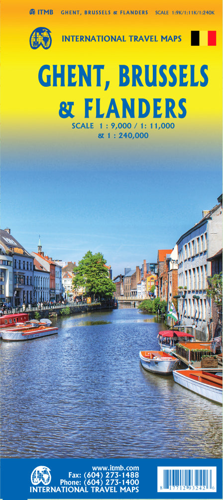
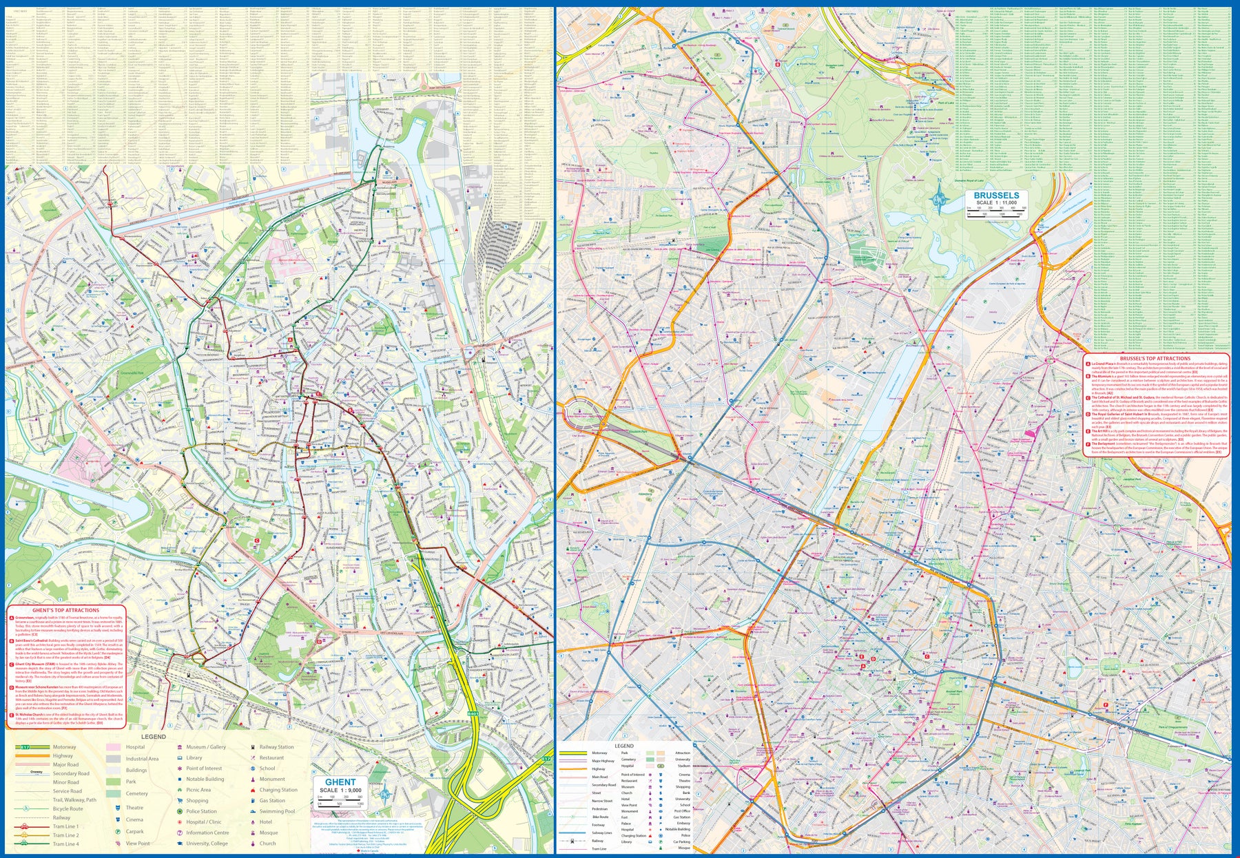
Belgium: Ghent; Brussels & Flanders
Ordinær pris 179,00 krGhent is one of the most historic cities in Europe. A city of canals, it became wealthy during the Middle Ages by controlling the production of cloth over several centuries. It is full of historic buildings and desperately needs a map or one becomes lost in the narrow streets that fill the ancient city centre. However, Ghent is not all that big so we have combined it with a detailed map of Brussels, the nominal capital of Belgium and the location of the European Union HQ. It was also the site of the famous world fair in 1968, the legacy of which is the Giant Atomium.
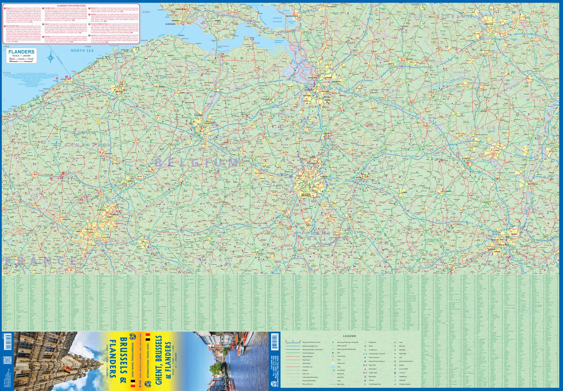
Side 2 of the map is also a new venture for us; a detailed map of Flanders region from Liege to Lille and from south of Brussels to north of Antwerp. This portion of both France and Belgium is full of historical importance and we hope to develop this artwork in future editions. For now, it is a detailed road map showing many fortresses/castles and monuments.
Bruges
Ordinær pris 129,00 krKompakte, laminerte kart, med litt turistinformasjon og bilder. Bykartene inneholder en index. De viktigste turistattraksjonene og bysentrum er gjerne forstørret.
This easy to use, full-colour, water-proof map is all you need to navigate Bruges. It also includes handy destination detail on Bruges environs and tips on top attractions and getting around. Combines clear, up-to-date cartography with destination detail, stylish design and stunning photography. The main map is at a scale of 1:7000, with prominent public buildings, hotels and other places of interest highlighted in the extensive index, including City Hall and the Belfry. Secondary maps cover Ghent, West Flanders and Ypres. But it's also much more than a map! - includes tips on top attractions, galleries, museums, heritage sites, travelling further afield, and getting around. Laminated finish is tough, waterproof and can be written on with a non-permanent marker pen - just write and wipe as required.
Publisert år: 2017
Innbinding: falset
Material: plast laminert
Målestokk: 1:7000
BRUXELLES
Ordinær pris 179,00 krDenmark: Faroe Islands
Ordinær pris 249,00 krFaeroe Islands at 1:100,000 on a large, indexed map from Freytag & Berndt with excellent presentation of their topography through contours at 50m intervals enhanced by relief shading, places of interest and ferry connections, etc, plus a street plan of Tórshavn.
The map, published by F&B in cooperation with the locally based Henrik Solberg, shows all the islands in their proper geographical locations rather than on separate panels. Topography is vividly presented by contours with hill shading, plus numerous spot heights. Car and/or passenger only ferry connections are marked. Road network includes country tracks and gives distances on main routes. The map also includes local footpaths and highlights several hiking trails. Symbols mark various facilities and places of interest including campsites, youth hostels and other tourist accommodation, picturesque towns, etc. Latitude and longitude lines are drawn at 5’ intervals. The index is next to the map. Map legend includes English.
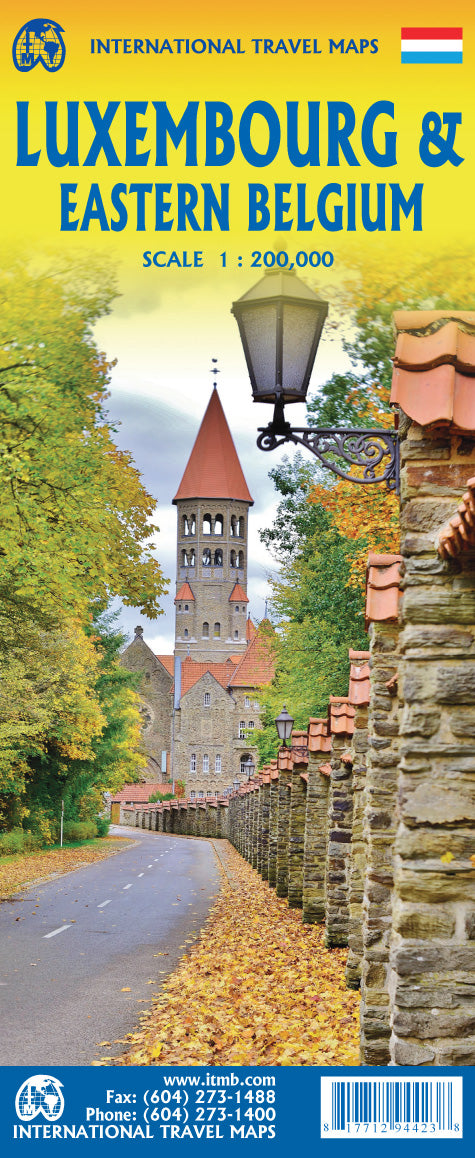
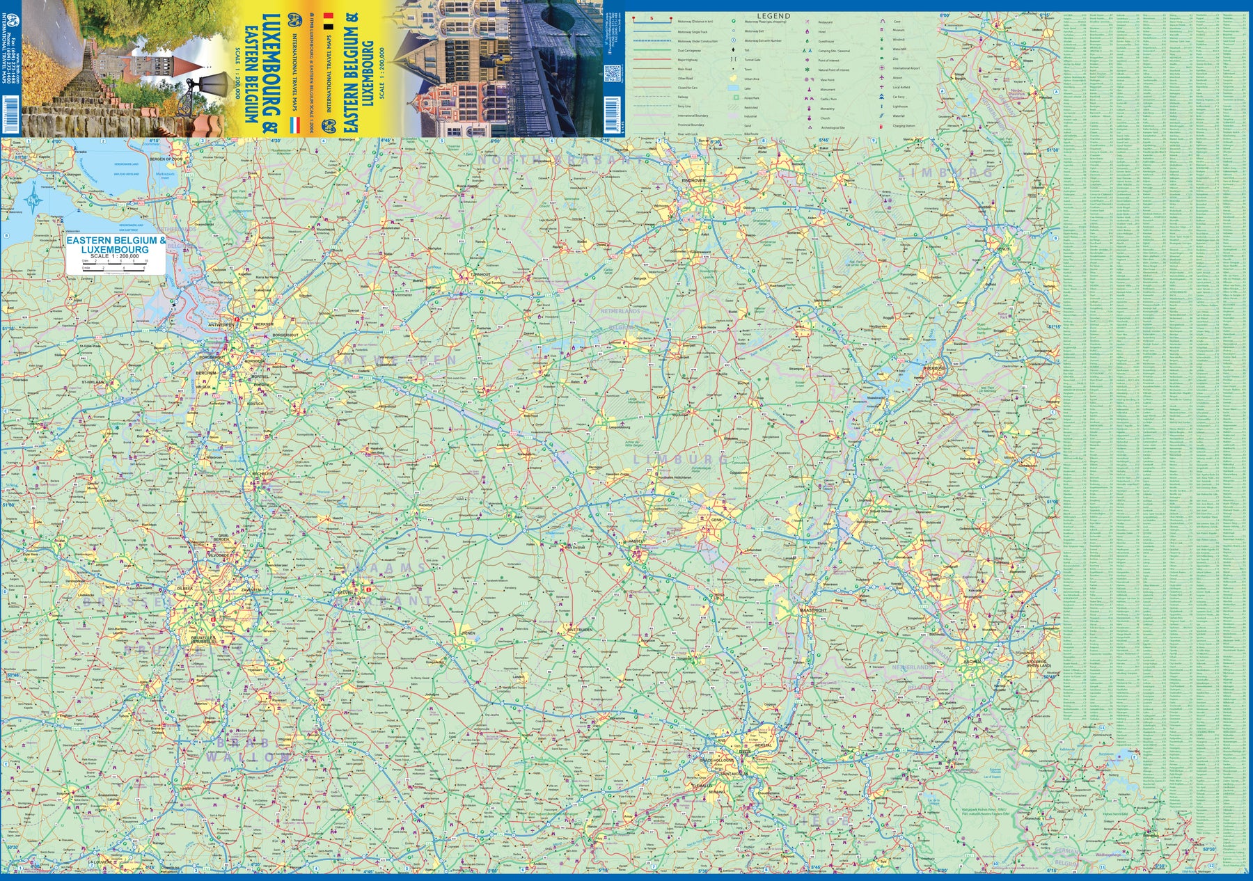
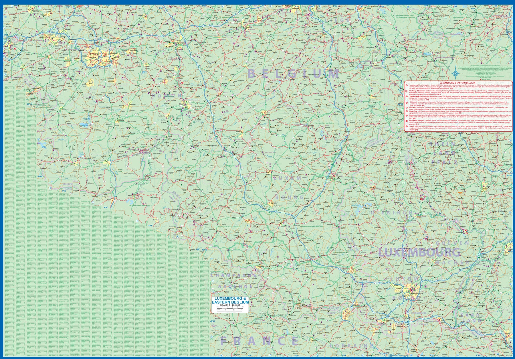
Luxembourg & Eastern Belgium
Ordinær pris 199,00 krLuxembourg is the largest of Europe’s mini-states. We have included the principality on maps of surrounding countries, as most publishers do, but we felt it was time to concentrate on the principality itself and place it into context with its neighbours. Bounded on the west by Belgium, on its east by Germany, and its south by France, Luxembourg has survived for centuries by playing off one large power against another in order to retain its independence. Largely a French-speaking area, Luxembourg is also a strong supporter of the EU. It is a mountainous country, part of the Ardennes region, and close to Bastogne, the focal point of Hitler's last attempt to break the Allies in what is now called the Battle of the Bulge. Bastogne, site of a marvelous WW2 museum, is also on Side 1, as is a portion of Belgium going as far as Mons.
Side 2 concentrates on Belgium east of Brussels, with a small portion of Netherlands included. This includes the Brussels region, Antwerp, Leuven, Liege, and Aachen, with a tiny portion of Germany. Belgium is a larger and more diverse country than many realize. One of the great treasure of eastern Belgium is the cathedral town of Liege, which is known in Flemish as Luik and in German as Luttich, which can make finding it a bit challenging, depending upon whose map one is using, or which road signs one is following!
Street Map: Bruges
Ordinær pris 149,00 krDiscover Bruges by foot, car or bike using Michelin Bruges City Plan (scale 1/12,500 cm). In addition to Michelin's clear and accurate mapping, this city plan will help you explore and navigate across Bruges different districts thanks to its full index, its comprehensive key showing places of interest and tourist attractions, as well as practical information on public transport leisure facilities, service stations and shops!Discover the new range of Michelin City Maps* Write on Wipe off ,Draw your route with a felt tipped pen, Erase with a damp cloth!* Plastic Format* Durable and convenient to use* Handy Compact, folds "free" for easy handling* Clarity and legibility of Michelin mapping:* Map of the city centre with identified tourist sites* Green Guide tourist sites* Smaller Map of whole city* Underground Map, with a detailed index.
Publisert år: 2020
Innbinding: Falset
Material: Plast
Målestokk: 1:12,500