16 produkter
16 produkter


16 produkter
Australia
Ordinær pris 119,00 krLonely Planet Planning Map er slitesterkt og vanntett, med en hendig slipcase og et format som er enkelt å brette. Få mer ut av kartet og reisen din med bilder og informasjon om toppattraksjoner i landet, reiseruteforslag, en transportguide, planleggingsinformasjon, temalister og praktiske reisetips. Med dette brukervennlige navigasjonsverktøyet i baklommen kan du virkelig komme til hjertet av din destinasjon!
Australia
Ordinær pris 169,00 krMarco Polo er svært detaljerte kart som er praktiske og enkle i bruk. 7 klistremerker for å markere spesifikke steder gjør det enda enklere å planlegge reisen. Alle kartene inneholder en omfattende index for enkelt å finne frem.
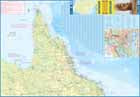
Australia: East
Ordinær pris 199,00 krHighly tear-resistant and 100% waterproof map "Australia, East" from the series world mapping project.
Travel know-how maps are characterized by particularly sturdy plastic paper, which can be written on like paper, even with a pencil. The cardboard envelope is removable, making it easy to put the card in any pocket. A protective cover is not required. The cartographic representation focuses on the most important information for travelers and is particularly easy to read. Instead of shading, colored layers of elevation are used. For the travel planning, important sights with photos including the indication of the grid square are inserted.
Attention: This map does not have a direct connection to the map "Australia West". For the central part of Australia, we refer to our map of Australia on a scale of 1:4,000,000.
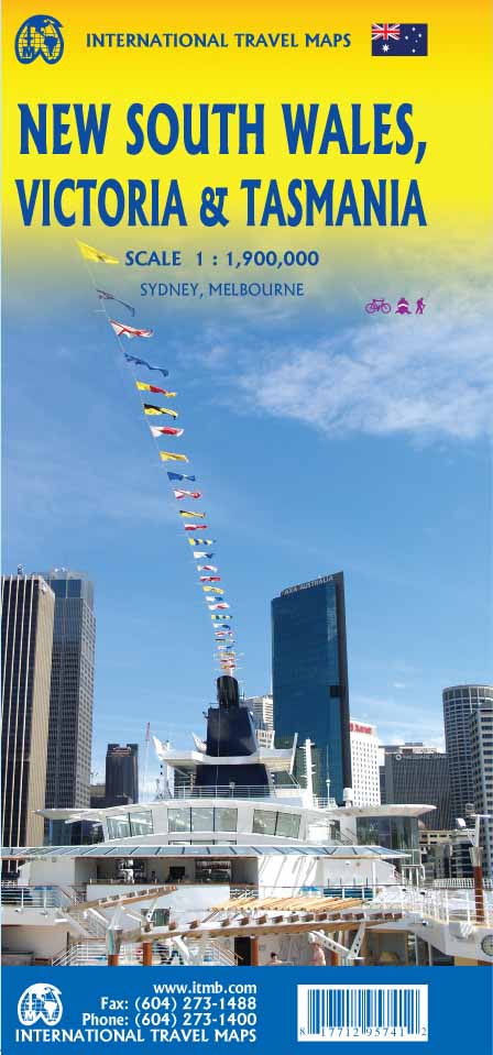
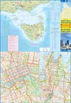
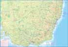
Australia: New South Wales; Victoria & Tasmania
Ordinær pris 169,00 krWe are pleased to announce the completion of our regional maps covering Australia with this map of the south-eastern segment of the country. This is the most densely-populated part of Australia, stretching from Lismore in the northeast to the Tasman Sea in the south. It includes all of New South Wales (NSW) and Victoria State, with South Australia as far west as Adelaide. It also shows Tasmania, Australia’s only island state, in good detail, as well as Flinders Island and King Island.
The map includes two very large inset maps of Melbourne and of Sydney. This map covers the travel plans of 90% of the visitors travelling around Australia, a continental country that is very difficult to see all of in one trip. The expanded scale we’ve used allows adequate room to include wilderness campgrounds, recreational vehicle parks, airports, petrol stations in more remote parts of the states, world heritage sites, national and state parks, and a host of points of interest.
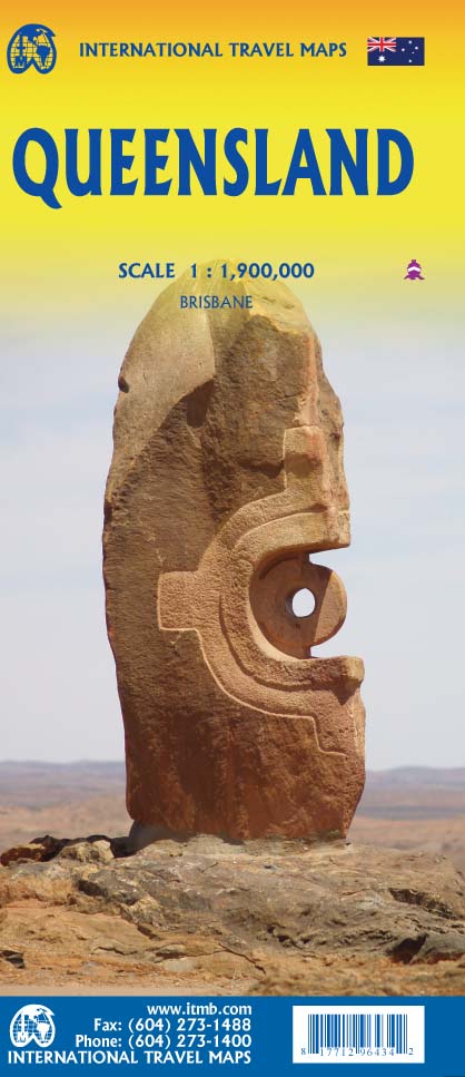
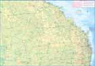
Australia: Queensland
Ordinær pris 199,00 krWe complete our series of regional maps covering Australia with this map of Queensland, which nicely fills a double-sided sheet with only small portions of adjoining states showing. The map also includes a large inset map of central Brisbane. At this scale, the road/rail network of this part of Australia becomes very clear. The first side concentrates on the northern portion of the state, and the other side, the more densely-developed southern half.
The map includes a listing of the state’s top attractions, and notes al major touristic attractions. Although gas/petrol stations are commonly found, we have included some gas symbols in remoter parts of Queensland to encourage drivers to venture into roads less travelled. All states and territories of Australia are now available from ITMB as separate maps, as well as our very popular country map.
Australia: Tasmania & Victoria
Ordinær pris 199,00 krThe island of Tasmania is Australia’s smallest state, but is packed with touristic delights. Hobart is the capital and a charming Victorian city in the south of the island. Much of the west coast is a large nature preserve with limited access and most development is close to the northern shore, centred on Devonport and its ferry connections with Melbourne, in Victoria State. Tasmania also administers several offshore islands, such as King, Flinders, and Bruny. We have included a Top Attractions listing for the reader to enjoy.
The other side of the sheet is the Australian mainland state of Victoria, best known as the home of Melbourne and the beautiful coastal highway to Adelaide. A basic inset map of Melbourne is included, but the focus of the map is on the recreational opportunities offered by the mountainous areas between Melbourne and Sydney, as well as the many interesting byways leading to towns with exotic names like Bendigo, Wngaratta, or Wagga Wagga. For convenience, the map area has been extended north to include Sydney, and an inset map of Sydney included. This map completes our coverage of each individual state, as well as of the country.
New Zealand
Ordinær pris 189,00 krLet the Marco Polo New Zealand Road Map guide you around this stunning country. Discover the Land of the Long White Cloud with this highly durable, detailed, touring map of New Zealand. It folds away easily and is always on standby to help when you're stuck.
New Zealand - North Island
Ordinær pris 219,00 krOur maps combine state-of-the-art, GPS-compatible cartography (including hypsometric tints and contour lines) with a detailed rendering of road networks and touristic information. They offer the best possible scale, level of detail and readability, be it a map of a small island or half a continent.
The maps feature a detachable paper sleeve so that the maps can be folded easily and fit in every pocket. Although printed on plastic, a special coating makes sure the maps retain a paper-like feel and can even be written on with a pencil.
New Zealand - South Island
Ordinær pris 199,00 krHighly tear-resistant and 100% waterproof map "New Zealand, South Island" from the series world mapping project.
Travel know-how maps are characterized by particularly sturdy plastic paper, which can be written on like paper, even with a pencil. The cardboard envelope is removable, making it easy to put the card in any pocket. A protective cover is not required. The cartographic representation focuses on the most important information for travelers and is particularly easy to read. Instead of shading, colored layers of elevation are used.
South Australia
Ordinær pris 119,00 krLonely Planet Planning Map er slitesterkt og vanntett, med en hendig slipcase og et format som er enkelt å brette. Få mer ut av kartet og reisen din med bilder og informasjon om toppattraksjoner i landet, reiseruteforslag, en transportguide, planleggingsinformasjon, temalister og praktiske reisetips. Med dette brukervennlige navigasjonsverktøyet i baklommen kan du virkelig komme til hjertet av din destinasjon!
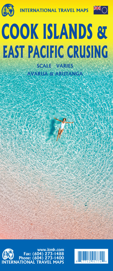
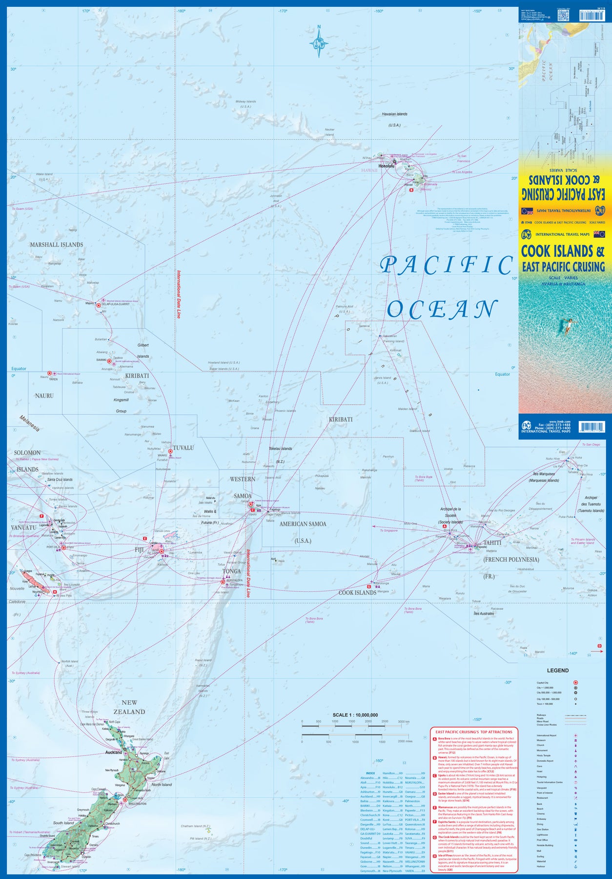
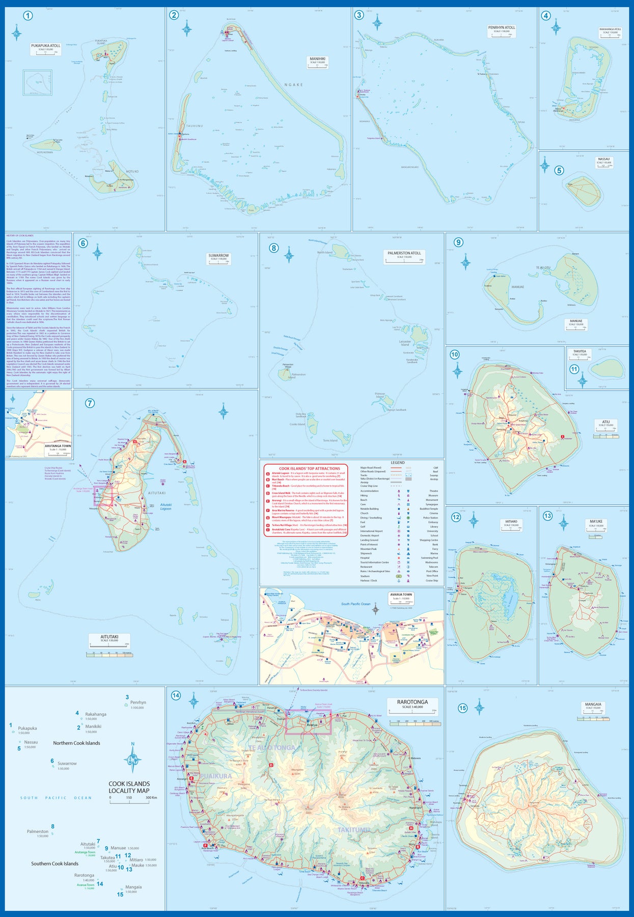
South Pacific: Cook Islands & East Pacific Cruising
Ordinær pris 179,00 krThis is a combination map, focused on two travel realities. Side 1 is a detailed map of the main islands making up the Cook Island archipelago. To provide more detail, the country is an inset map in the lower left corner, with numbers in blue, up to 15. The main map on Side 1 is a series of inset maps providing excellent detail of individual islands, such as Raratonga, Mangaia, or Aitutaki, or island groupings of more northerly groupings that are little more than atolls, such as Penrhyn or Palmerston. The capital is Avarua, and an inset map is included; also one of Arutanga on Aitutaki. The country is well-positioned for tourism, and has many resorts, particularly on Raratonga.
Side 2 is a new map for ITMB, part of our growing Cruising line. This on covers the eastern portion of the South Pacific, from the Marshall Islands, Nauru, and the Solomons on the west to Hawaii and Tahiti on the east, and as far south as New Zealand. Other island nations included on this map are Kiribati, Tuvalu, Fiji, Samoa, and New Caledonia. By the nature of portraying a vast ocean, little detail of each island can be provided. The purpose of this map is to show routes followed by ships visiting the overall region. This is a rapidly-growing travel area for major cruise lines, and promises to be as attractive in the future as cruises in the Caribbean or Mediterranean. This region holds great prospects for the future. Besides, it is a lovely map to look at.
South Pacific: Oceania Cruising & New Caledonia
Ordinær pris 179,00 krThe South Pacific island complex known as New Caledonia, or Nouvelle Caledonie in French, consists of a main island and half a dozen smaller islands (collectively called the Loyalty Islands. It is an overseas possession of France and uses the Euro as its currency. It is located about halfway between Australia and Fiji and is south of Vanuatu. The main island is one of the larger land masses in the Pacific, with a reasonably well-developed road infrastructure linking the capital city of Naomea with other urban areas. There are resort hotels at various locations along the coastline, but this is a territory that one would have to regard as being adventuresome. Most of the attractions are concentrated in the vicinity of the capital. The islands were important surveillance zones during WW2, and the territory is popular with Australians and New Zealanders.
The reverse side of the sheet portrays the South Pacific for cruising, covering from Hawaii to the Marianas, down to New Guinea, and includes the eastern half of Australia, all of New Zealand, American Samoa, Fiji, and Tonga in the centre, with Tuvalu, Kiribati, and the Marshall Islands to the north and the Cook Islands and Tahiti to the east. This is an increasingly popular part of the world for cruise ship activity, as it combines affluent population areas in Australasia and the USA with exotic, but safe, travel destinations that are expensive to reach by any means except cruise ships. This is a brand new title for ITMB and expands our coverage of both the southern portions of the Pacific with yet another first-time map.
Tasmania
Ordinær pris 119,00 krLonely Planet Planning Map er slitesterkt og vanntett, med en hendig slipcase og et format som er enkelt å brette. Få mer ut av kartet og reisen din med bilder og informasjon om toppattraksjoner i landet, reiseruteforslag, en transportguide, planleggingsinformasjon, temalister og praktiske reisetips. Med dette brukervennlige navigasjonsverktøyet i baklommen kan du virkelig komme til hjertet av din destinasjon!
Western Australia
Ordinær pris 119,00 krLonely Planet Planning Map er slitesterkt og vanntett, med en hendig slipcase og et format som er enkelt å brette. Få mer ut av kartet og reisen din med bilder og informasjon om toppattraksjoner i landet, reiseruteforslag, en transportguide, planleggingsinformasjon, temalister og praktiske reisetips. Med dette brukervennlige navigasjonsverktøyet i baklommen kan du virkelig komme til hjertet av din destinasjon!