23 produkter
Aksu - China, Kyrgyzstan
Ordinær pris 199,00 krFire fargers topografiske kart, med tekst (engelsk) på baksiden. Tekst inneholder noe historie, geologi, klima, flora og fauna, samt tilgang, turstier, medisinske aspekter ol. Størrelse er 85 x 65 cm (ca a1).
Publisert år: 2006
Innbinding: falset
Material: papir
Målestokk: 1:500000
Beijing
Ordinær pris 129,00 krKompakte, laminerte kart, med litt turistinformasjon og bilder. Bykartene inneholder en index. De viktigste turistattraksjonene og bysentrum er gjerne forstørret.
Publisert år: 2017
Innbinding: falset
Material: plast laminert
Målestokk: 1:26000
Beijing
Ordinær pris 119,00 krLonely Planet City Map er slitesterkt og vanntett, med en hendig slipcase og et format som er lett å brette. Få mer ut av kartet og reisen din med bilder og informasjon om byattraksjoner, transportkart, reiseruteforslag, omfattende gate- og nettstedsindeks og praktiske reisetips. Med dette brukervennlige navigasjonsverktøyet i baklommen kan du virkelig komme til hjertet av din destinasjon!
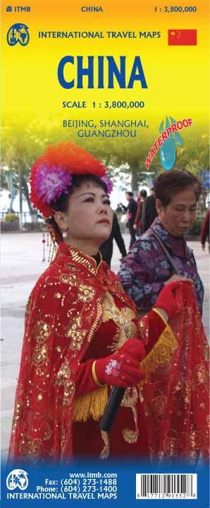
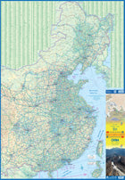
China
Ordinær pris 199,00 krChina - East
Ordinær pris 169,00 krTysk kartserie med flotte kart på slitesterkt plastpapir.
Eastern China at 1:2,700,000 on light, waterproof and tear-resistant plastic paper, with both topographic and tourist information. The map, part of Reise Know-How's highly acclaimed "World Mapping Project", is double-sided, to provide the best balance between a good scale and a convenient size sheet. Place names of larger towns are shown both transliterated and in the Chinese script; all other names are in the Latin alphabet only. Coverage includes North and South Korea.
Topography is indicated by altitude colouring with spot heights and names of mountain ranges, hills and deserts. Salt lakes, swamps, seasonal rivers and glacier are also shown. Detailed presentation of the road network includes minor roads and tracks. The map also shows the rail network and local airports. Administrative units are shown with their boundaries and names. National parks and other protected areas are highlighted. A wide range of symbols mark various places of interest including the Great Wall of China, UNESCO world heritage sites, temples, museums, spas and hot springs, etc. Latitude and longitude lines are drawn at 2º intervals. The map is indexed and its map legend includes English.
Publisert år: 2015
Innbinding: falset
Material: plastpapir
Målestokk: 1:2700000
China Central
Ordinær pris 129,00 krChina: Beijing & The Great Wall
Ordinær pris 149,00 krITM har kart over hele verden og de spesialiserer seg på land litt utenfor allfarvei. Beliggenheten til landets nasjonalparker, historiske monumenter, de viktigste veiene o.L. Finner du inkludert i kartene. Samtlige landkart har ofte et bykart over hovedstaden.
4th edition January 2015. Beijing in scale 1:23.000 The other side of the map is just as interesting. It covers the portion of the Great Wall of China that all visitors see, near Badaling (scale 1:280.000), and also shows those sections that have disappeared over time, or have fallen into disrepair. As well, the famous Ming tombs of former emperors is also shown, as well as the Marco Polo bridge on the western edge of Beijing, so-named in honour of the famous trader/explorer who set out from this point on his return trip to Europe. This time, we have printed our Beijing/great Wall map in durable ITM plastic; printed double-sided.
Publisert år: 2015
Innbinding: falset
Material: plastpapir
Målestokk: 1:280000
China: Hong Kong & Region
Ordinær pris 149,00 krITM har kart over hele verden og de spesialiserer seg på land litt utenfor allfarvei. Beliggenheten til landets nasjonalparker, historiske monumenter, de viktigste veiene o.L. Finner du inkludert i kartene. Samtlige landkart har ofte et bykart over hovedstaden.
Fra ITM: 4th edition 2016. Hong Kong is a double-sided map in scale 1:10.000/1:60.000, printed on waterproof paper.A street plan of Hong Kong with Kowloon at 1:10,000 and on the reverse a road map of the HK Special Administrative Region at 1:60,000, plus a diagram of the transport network. The street plan show Hong Kong and Kowloon at 1:10,000 with colouring for the main traffic arteries, very clear presentation of the highway junctions, and marking for one way streets. Where appropriate, MTR and KCR stations are shown with multiple entrances/exits, and the map also shows the double-decker tram line, the Mid-Levels Escalator and the ferry connections across the Victoria Harbour and Kowloon Bay. The plan also shows pedestrianized streets and those with staircases in the hilly part of the Hong Kong Island. Various places of interest and facilities are highlighted, including selected hotels. On the reverse is an indexed road map of the Hong Kong SAR at 1:60,000, extending north to Shenzehen. Altitude colouring shows the topography. Railway and ferry connections are marked and numerous places of interest are highlighted. On both sides place names are given in the Latin alphabet only, with on the road map selected location also shown in Chinese. The map includes a diagram of the transport network.
Publisert år: 2016
Innbinding: falset
Material: plastpapir
Målestokk: 1:10000/60000
China: Shanghai & Southeast
Ordinær pris 169,00 krITM har kart over hele verden og de spesialiserer seg på land litt utenfor allfarvei. Beliggenheten til landets nasjonalparker, historiske monumenter, de viktigste veiene og lignende. Finner du inkludert i kartene. Samtlige landkart har ofte et bykart over hovedstaden.
Fra ITM: 4th Edition Although Shanghai is not the largest city in China (that record belongs to Chongching), at 24,000,000 plus people, it is an enormous area. It is one of the best-known of china's mega-cities, situated on the Huangpu River, close to the ocean. The map covers the urban area from the main railway station in the north to the Xuhui area in the south and from East China university campus to the Maglev station in the east. An inset map shows the Maglev route to Pudong International Airport. The touristic core of Shanghai is portrayed in excellent detail. The Bund, along the riverfront, is well-known, all the streets in the Old Town are shown, as is the main shopping district along Nanking Road. Ferry routes along the river are shown, as well as a good selection of hotels. The various rapid transit lines are also shown. The reverse side of the map portrays most of eastern China, from Beijing to Hong Kong to Xi'an in the west. China is evolving quite rapidly and has constructed a complex series of motorways and super-speed train lines in recent years. These are all shown in very good detail. The map also includes the island of Taiwan, claimed by China, but independent. The regional map covers the area of interest for the vast majority of visitors to China, including two dozen mega-cities of more than 5 million people each.
China: South
Ordinær pris 149,00 krITM har kart over hele verden og de spesialiserer seg på land litt utenfor allfarvei. Beliggenheten til landets nasjonalparker, historiske monumenter, de viktigste veiene o.L. Finner du inkludert i kartene. Samtlige landkart har ofte et bykart over hovedstaden.
Fra ITM: 1st edition October 2015. This map in scale 1:3 mio. concentrates on the part of China from Shanghai south and all the way west to Lhasa and includes Taiwan and Hainan Island. We are not trying to make any sort of political comment here, but geographically, both Tibet and Taiwan fall within the area of coverage and are both included for this reason alone. Inset maps of Hong Kong, Guangzhou (1:850.000) and Shanghai. Legend Includes: Roads by classification, Points of Interest, National Parks, Airports, Golf Courses, Beaches, Campsites, Waterfalls, Viewpoints, Churches, Surfing/Scuba Diving Spots, Fishing Spots, Hospitals, harbours/Ports, Lighthouses, Museums, Monuments, Caves, Mosques, Mountain Peaks, Botanic Gardens, Wildlife Sanctuary, Zoos, Sports Fields, and much more.
Publisert år: 2015
Innbinding: falset
Material: Plastpapir
Målestokk: 1:3000000
China: South & Guangzhou
Ordinær pris 149,00 kr Salgspris 119,00 kr Spar 20%China, as a country, is very popular with travellers. However, China is also a very large geographical entity and showing the entire country on one map results in a scale that reduces the amount of information that can be shown. The most visited part of the country is the south, with rapid train access from Hong Kong and major airports at Guangzhou and Shanghai. Travel to China is also increasing as more international airports are opened. The regional map covers one side of this double-sided map; the other contains an updated map of Guangzhou (formerly Canton). Lan and I visited this city in February and were surprised at how open and modern the city is. In comparison with Beijing, the political overtones are much reduced, and Sun Yat Sen is the hero. The city is also a major train hub, with two major stations handling traffic, and six bus stations arranging transportation to nearby cities.
Hong Kong
Ordinær pris 119,00 krLonely Planet City Map er slitesterkt og vanntett, med en hendig slipcase og et format som er lett å brette. Få mer ut av kartet og reisen din med bilder og informasjon om byattraksjoner, transportkart, reiseruteforslag, omfattende gate- og nettstedsindeks og praktiske reisetips. Med dette brukervennlige navigasjonsverktøyet i baklommen kan du virkelig komme til hjertet av din destinasjon!
Hong Kong
Ordinær pris 99,00 krThis easy to use, full-colour, waterproof map is all you need to navigate Hong Kong. It also includes dotted highlight sights such as Major Attractions, Notable Buildings, Museums and Galleries, Shopping/Markets/Nightlife, The New Territories and Outlying Islands, as well as essential information on getting around. Features of this tap to Hong Kong:- Detailed cartography: produced to the highest cartographic standards, highlighting all the main tourist sights, places to visit and transport networks- Informative text: useful travel information, essential facts about the destination, recommendations for the best places to see and tips for getting around- Easy to use: lightweight and wipe-clean in a handy pocket-size format.
Publisert år: 2019
Innbinding: falset
Material: Plast Laminert
Målestokk: 1:60000
Hong Kong
Ordinær pris 99,00 krKart i postkortstørrelse. Folder seg ut som en popoutbok når du åpner dem. Fargerik turistinformasjon med kart over metro og busstraseer, landemerker og lignende. Veldig enkel å håndtere.
Publisert: Des. 2018
Innbinding: pop
Material: papp, papir
Shanghai
Ordinær pris 129,00 krShanghai
Ordinær pris 119,00 krLonely Planet City Map er slitesterkt og vanntett, med en hendig slipcase og et format som er lett å brette. Få mer ut av kartet og reisen din med bilder og informasjon om byattraksjoner, transportkart, reiseruteforslag, omfattende gate- og nettstedsindeks og praktiske reisetips. Med dette brukervennlige navigasjonsverktøyet i baklommen kan du virkelig komme til hjertet av din destinasjon!
Street Map: Shanghai
Ordinær pris 149,00 krDiscover Shanghai by foot, car or bike using Michelin Shanghai City Plan (scale 1/17,500 cm). In addition to Michelin's clear and accurate mapping, this city plan will help you explore and navigate across Shanghai different districts thanks to its full index, its comprehensive key showing places of interest and tourist attractions, as well as practical information on public transport leisure facilities, service stations and shops!Discover the new range of Michelin City Maps* Write on Wipe off, Draw your route with a dry marker tipped pen, Erase with a damp cloth!* Plastic Format* Durable and convenient to use* Handy Compact, folds "free" for easy handling* Clarity and legibility of Michelin mapping:* Map of the city centre with identified tourist sites* Green Guide tourist sites* Smaller Map of whole city* Underground Map, with a detailed index.
Publisert år: 2019
Innbinding: Falset
Material: Plast
Målestokk: 1:15,000