47 produkter
47 produkter


47 produkter
Austria
Ordinær pris 209,00 krLower Austria
Ordinær pris 199,00 krUpper Austria
Ordinær pris 199,00 kr9 Kaisergebirge
Ordinær pris 199,00 krKompass sine vandrekart er av de aller beste til sitt bruk, de er lettleste, detaljerte og oppdaterte! De spesialiserer seg på Sentral-Europa (de tysktalende landene samt Italia og Spania), hvor de er de mest solgte vandrekartene i vår butikk. De har selvfølgelig GPS-koordinater, samt en liten guide følger hvert kart, men vær oppmerksom på at denne er på tysk!
Alps
Ordinær pris 169,00 krPerfect touring map - the scale is 1 : 650 000 ideal to help you tour the region by car or campervan. Easy to use - the superbly clear mapping in strong colours and easy to read text will help you navigate the country like a local. Durable, tear-resistant map - designed to withstand the rigors of the road, the map is printed on tear-resistant, water repellent and writeable paper. Highlights included - major sights and key points of interest are marked on the map by numbered stars. Further information about these key sights can be downloaded via a QR code where you'll find a brief description to help you pick the best places to see en-route. Dream routes - inspirational routes with beautiful scenery are included on the maps to guide you on your next adventure. Extensive index - the thorough index, also included on the QR code, is fully cross-referenced to the map to help you pinpoint your destination quickly For the big trips and the little detours, trust Marco Polo's clear mapping and thorough index to guide you around the Alps.
Austria
Ordinær pris 199,00 krDette store østerrikske kartforlaget er kjent for sin klare kartografi og gode papirkvalitet. De kommer i alle målestokker, og flere av landkartene inneholder bykart og turistinformasjon.
Austria
Ordinær pris 189,00 krMarco Polo er svært detaljerte kart som er praktiske og enkle i bruk. 7 klistremerker for å markere spesifikke steder gjør det enda enklere å planlegge reisen. Alle kartene inneholder en omfattende index for enkelt å finne frem.
Austria
Ordinær pris 189,00 krDette store østerriske kartforlaget er kjent for sin klare kartografi og gode papirkvalitet. De kommer i alle målestokker, og flere av landkartene inneholder bykart og turistinformasjon.
Publisert år: 2022
Innbinding: falset
Material: papir
Målestokk: 1:500000
Austria: Rail & Road
Ordinær pris 199,00 krAustria is both an ancient country and a modern country. It was a powerful empire prior to the French Revolution (Marie Antoinette was an Austrian princess prior to her marriage to the king of France), and WW1 was strongly influenced by the Austro-Hungarian empire. The aftermath of that war resulted in Austria becoming much diminished in power, but despite WW2, its borders remain much as they were in 1918. That said, today's Austria is a lovely and safe place to visit. 75 years of peaceful neutrality has restored the country to prosperity and the country is loaded with picturesque villages, lovely mountain scenes, historic castles and palaces, wonderful churches, and museums galore.
This map emphasises the rail network that is the best way to travel around the country, but also shows motorways and ordinary highways, parks, scenic attractions, and connections to surrounding countries.
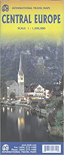
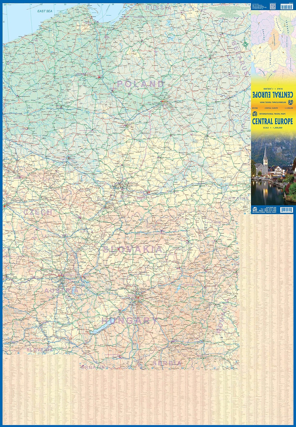
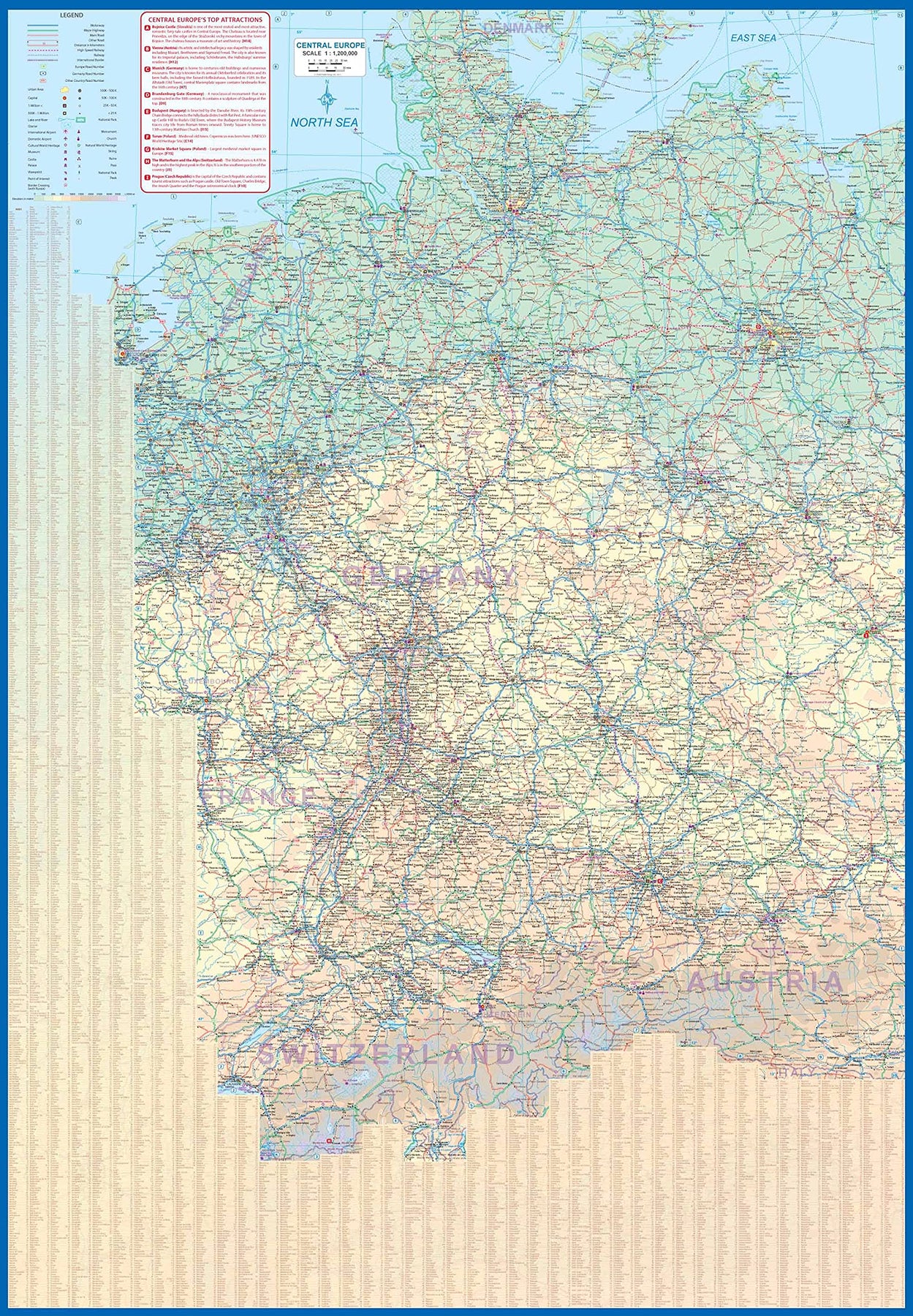
Europe Central
Ordinær pris 199,00 krEurope is fairly big, and densely populated. A map of all of Europe is useful, but at a scale that limits our ability to show information. As a result, last year we published a map of Western Europe. Now, we are pleased to extend our more detailed coverage of the continent with a map covering the Central European countries of Germany, Austria, Poland, Czech Republic, Hungary, Slovakia, and Switzerland, with portions of France, Belarus, Serbia, and Romania. A third map, covering eastern European countries, will be released soon, providing detailed regional coverage of the continent in a way that we hope is pleasing. Germany occupies most of the first side, and Poland the other, with Czech and Slovakia divided between the two sides, and Slovakia/Hungary filling the rest of side 2.
This is a regional map, showing rail lines as well and roads, airports, and major touristic attractions. A listing of the region’s top attractions is included. This map will appeal to those visiting several countries on one trip, by rail or road. Legend Includes: Roads by classification, Rivers and Lakes, National Park, Airports, Points of Interests, Highways, Main Roads, Zoos, Fishing, and much more...
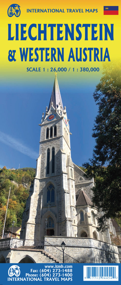
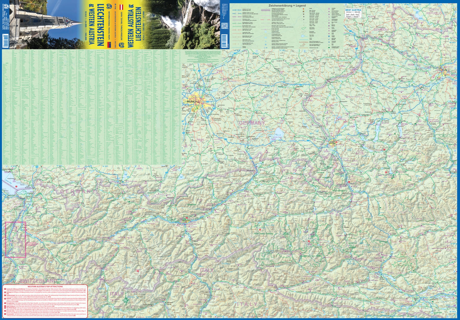
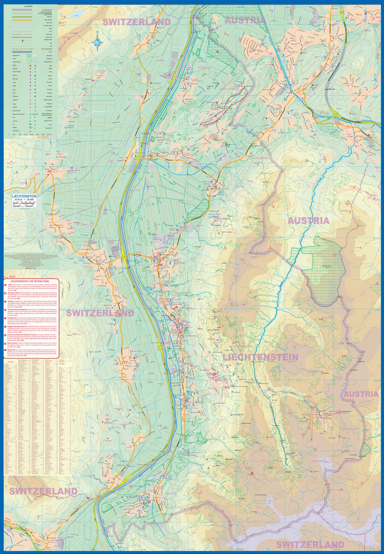
Liechtenstein & Western Austria
Ordinær pris 179,00 krEurope is dotted with mini-states that exist solely for historic reasons but are fiercely independent. Liechtenstein, surrounded by Switzerland on its west and south and Austria on its other borders, is such a state. It is larger and more diverse than many imagine and is quite a popular ski resort region. Side 1 is a detailed map of the principality, framed on the west by the Rhine River and a bit of Switzerland and on the east by Austria. Most development occurs in the Rhine Valley in a north-south direction, dominated by the capital city of Vaduz. There are five access points from Switzerland across the Rhine, one from the south, and two from Austria in the north. The ski haven of Malbun is prominently shown, and the scale of the map is detailed enough to name every major street. This also enabled us the opportunity to include schools, shopping areas, post offices, and churches, as well as a wide range of eating establishments. Walking/hiking trails have also been included.
This is the only map of Liechtenstein ever produced by a cartographic firm, and joins Andorra, Luxembourg, and Monaco as a valued part of ITMB's coverage of Europe. Side 2 concentrates on eastern Austria and southern Germany from Lake Boden (Bodensee) to Linz and from the Italian border north to Passau, in Germany. It is both a road/rail map and a physical relief map of this portion of the Alps. It includes its own Top Attractions list. Border crossings are shown merely as a formality, except for Switzerland. This would be an excellent map to use to explore the mountains south of Innsbruck or to discover small villages in the Tirol.
The Alps Atlas
Ordinær pris 449,00 kr