58 produkter
58 produkter


58 produkter
Japan: West & Central Railway & Road
Ordinær pris 179,00 krITM har kart over hele verden og de spesialiserer seg på land litt utenfor allfarvei. Beliggenheten til landets nasjonalparker, historiske monumenter, de viktigste veiene o.L. Finner du inkludert i kartene. Samtlige landkart har ofte et bykart over hovedstaden.
Kyrgyzstan & Tajikistan
Ordinær pris 179,00 krThe two Central Asian countries of Kyrgyzstan and Tajikistan are rapidly developing a touristic market and we feel that the world needs a good map to reflect their growing importance. The two ‘stans were part of the Soviet empire that fell apart in 1990, creating a dozen new countries. This double-sided map covers Kyrgyzstan on one side, with an inset map of its capital, Bishkek. The main attractions are Osh and Suyab, both ancient market centres on the Silk Road, and Lake Issyk-Kul, the world’s second largest alpine lake.
The reverse side concentrates on Tajikistan mountainous country just west of the Himalayas, with an inset of its capital, Dushanbe. Both of these countries should be considered ‘adventure’ destinations. Legend includes: International Boundary, Province Boundary, Distance (km), Motorway, Other Road, Track, Railways, Town, Village, Ferry, International Airport, Harbour, Border Crossing, Museum, Church, Place, Historical Site, Tomb, Mine, Viewpoint , etc.
Lebanon & Beirut
Ordinær pris 189,00 krITM har kart over hele verden og de spesialiserer seg på land litt utenfor allfarvei. Beliggenheten til landets nasjonalparker, historiske monumenter, de viktigste veiene o.L. Finner du inkludert i kartene. Samtlige landkart har ofte et bykart over hovedstaden.
Fra ITM: Lebanon has had a rather troubled political history over the past fifty years, but is a lovely country to visit. Tripoli, for example, is fascinating to explore The Crusader citadel (circa 1100AD) can be toured, and the Great Mosque is well worth a visit. Baalbek used to be known as Heliopolis, two thousand years ago, when it was the most important Greek, then Roman, city in the Eastern Mediterranean. It is still the most complete Roman city in the world, and a UNESCO World Heritage site. Byblos has been occupied for 7,000 years. The Cedars of God are over 1,500 years old. Tyre dates back to 3,000BC. Sidon is a former Silk Road trading post. Beirut is one of the oldest cities in the world. This is why people want to visit Lebanon. Our map shows the country on one side, with ample text blocks to entice the reader, and Beirut on the other side. Truly an amazing country!
Publisert år: 2019
Innbinding: falset
Material: papir
Målestokk: 1:190,000 / Beirut: 1:8,300
Middle East Atlas
Ordinær pris 179,00 krITM har kart over hele verden og de spesialiserer seg på land litt utenfor allfarvei. Beliggenheten til landets nasjonalparker, historiske monumenter, de viktigste veiene o.L. Finner du inkludert i kartene. Samtlige landkart har ofte et bykart over hovedstaden.
Publisert år: 2012
Innbinding: hft
Material: papir
Målestokk: flere
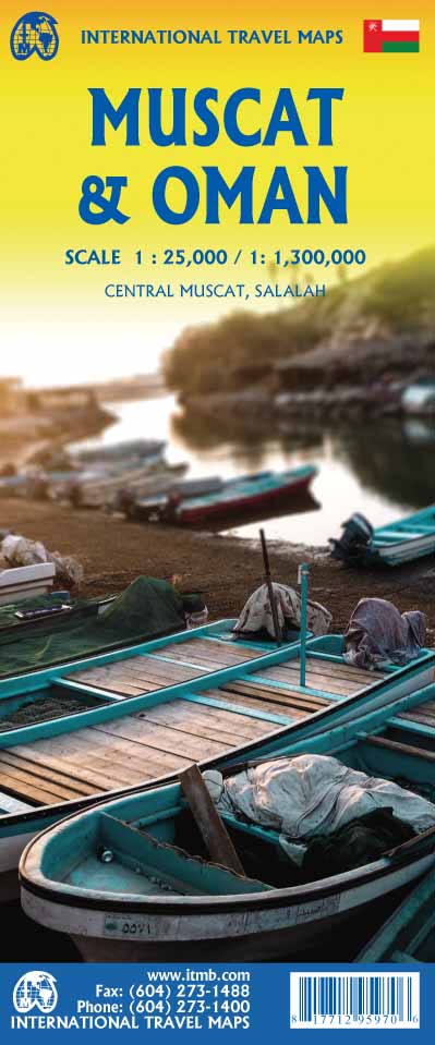
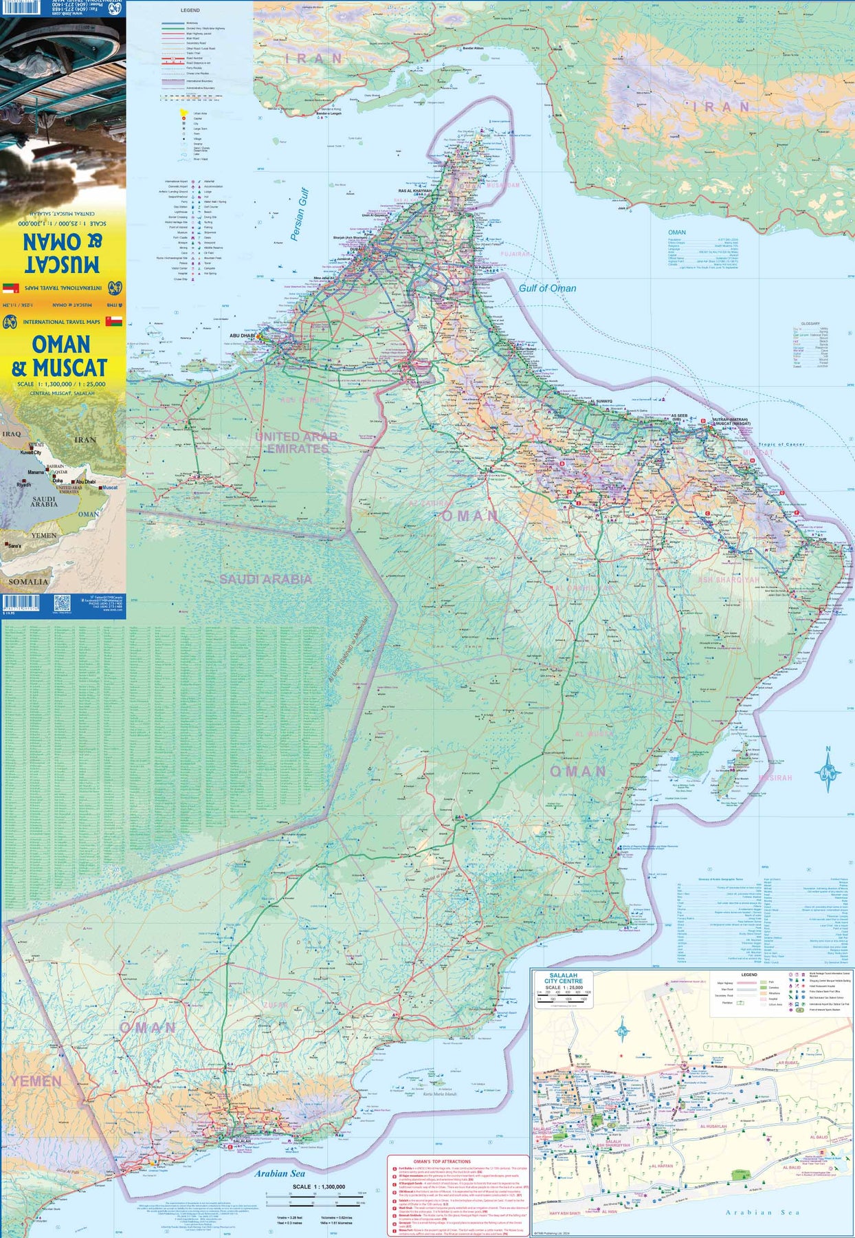
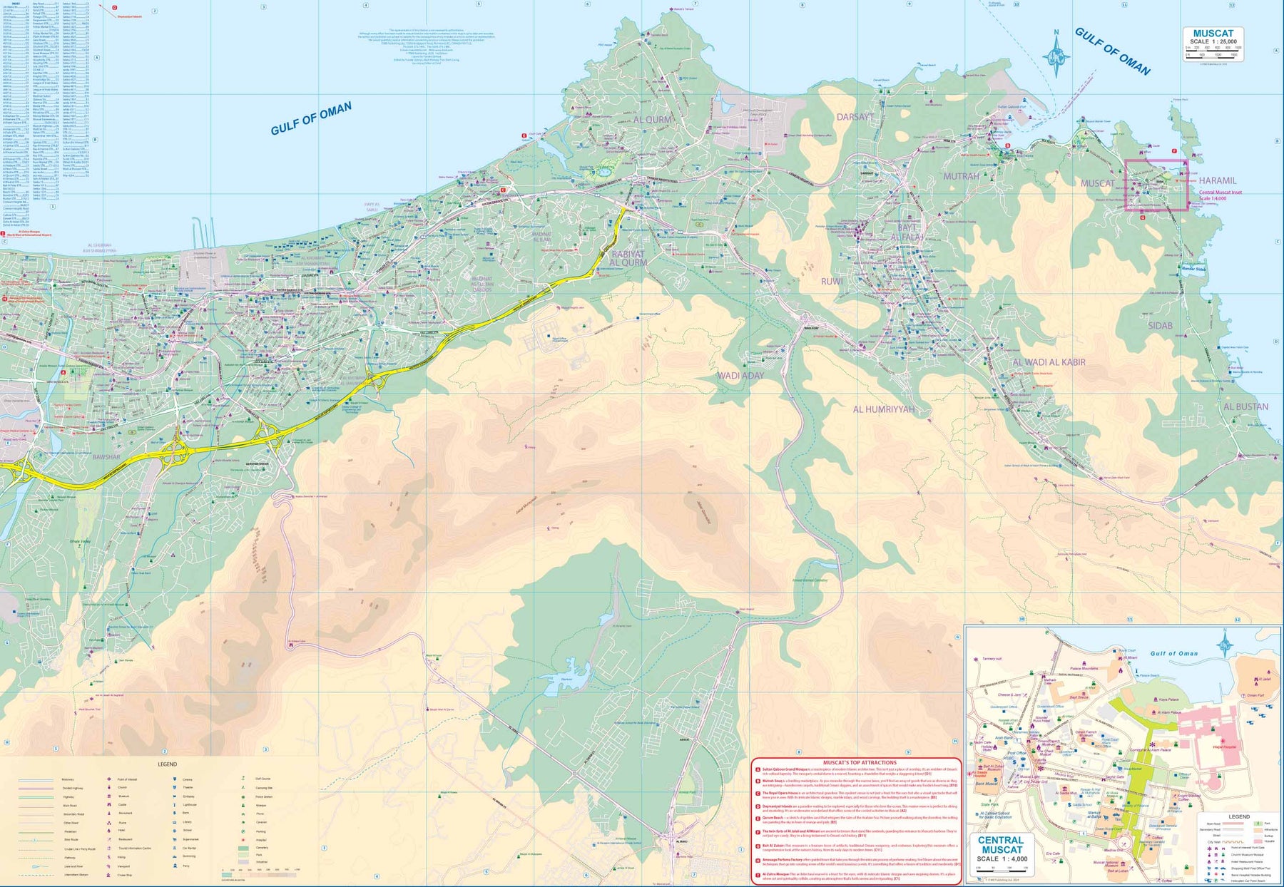
Muscat & Oman
Ordinær pris 179,00 krThe very name Muscat and Oman entices one! The peninsula at the access point to the Persian/Arabian Gulf sounds very exotic - and it is! This double-sided map focuses on the city and region of Muscat on side one at a detailed scale, noting the Grand Mosque, the Mutrah Souk, and the Royal Opera House as well as showing hotels, shopping areas, and other sites of touristic interest. Muscat used to be a British protectorate, but is now part of Oman, albeit physically separated from it by a portion of the UAE.
The country fills side 2. Oman is portrayed as a north-south alignment, as it is long and not particularly wide, and nicely fills the sheet, with an inset of Salalah, close to the Yemeni border. Connections to nearby Abu Dhabi and Dubai are also shown. Oman is a haven of peaceful co-existence, and tourists are welcome, so this map is designed to encourage visitors.
Myanmar (Burma)
Ordinær pris 149,00 krITM har kart over hele verden og de spesialiserer seg på land litt utenfor allfarvei. Beliggenheten til landets nasjonalparker, historiske monumenter, de viktigste veiene o.L. Finner du inkludert i kartene. Samtlige landkart har ofte et bykart over hovedstaden.
2nd edition 2013. Folded map in scale 1:1,35 mio. Legend Includes: Roads by classification, Ferry routes, International Airports, Domestic Airports, Border crossings, Railway stations, Bus terminals, Harbours, Hotels, Campsites, Banks, restaurants, Libraries, Post offices, Shopping centers, Universities, Schools, Police stations, Embassies, Hospitals, Notable Buildings, Tourist information centers, Cinemas, Palaces, Museums, Churches, Temples, Mosque, Synagogues, Pagodas, World heritqges sites, Ruins, Points of interest, Viewpoints, Beaches, Bird Sanctuary, Nature Reserve, Wildlife areas, Diving, Caves, Zoos, Golf courses, Stadiums, Oil weils, Mines, and much more...
Publisert år: 2013
Innbinding: falset
Material: papir
Målestokk: 1:1350000
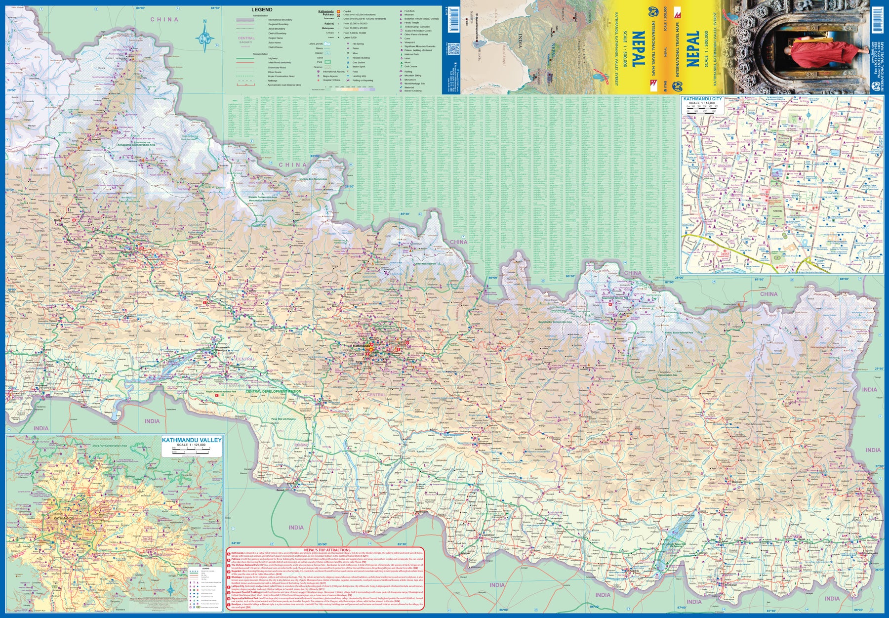
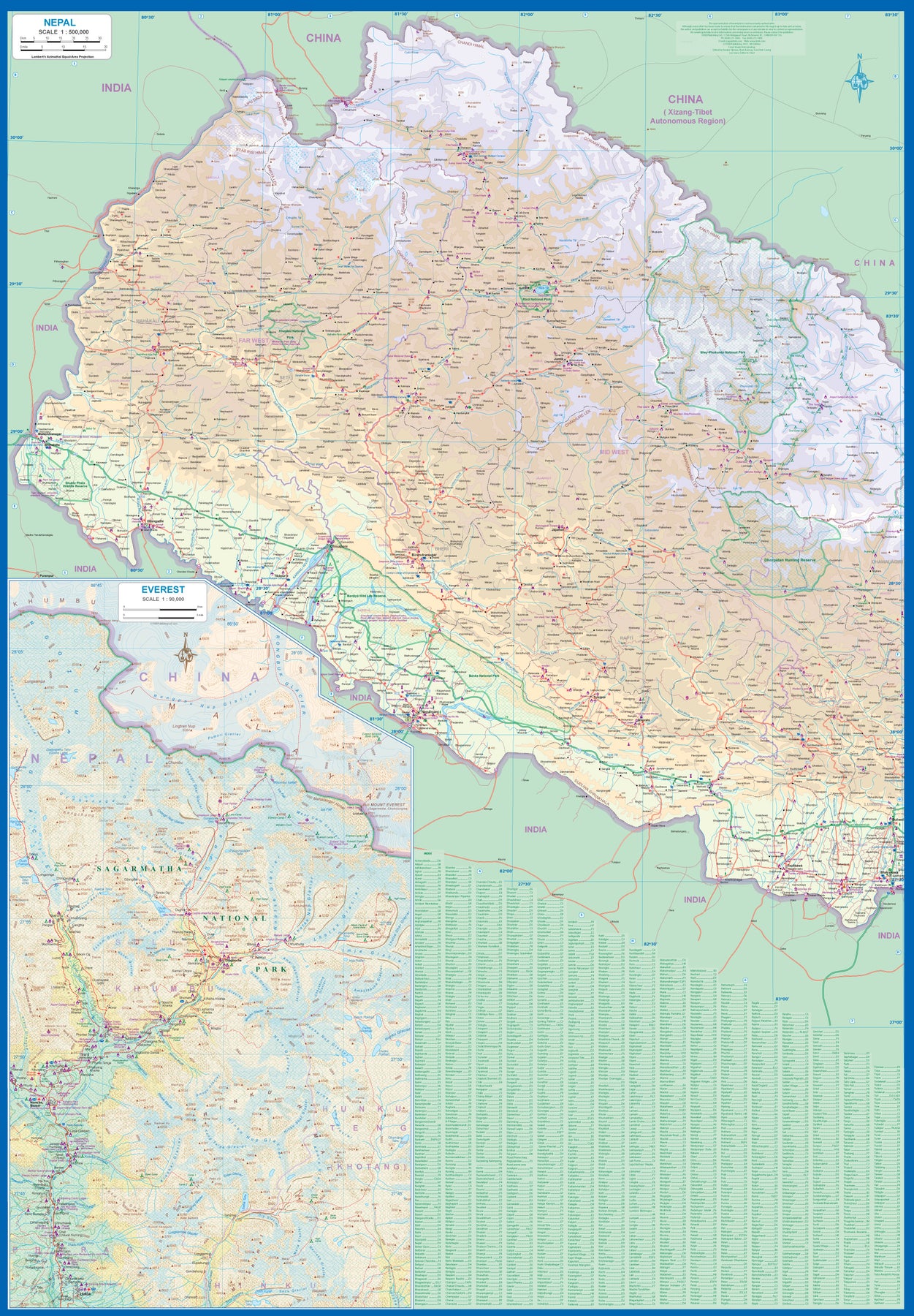
Nepal
Ordinær pris 169,00 krNow it is time to re-introduce the world to one of the most fascinating countries on Planet Earth. Side 1 covers western Nepal around Pokhara and has a detailed inset map of the Mount Everest area in an expanded scale. Side 2 covers the portion of the country from just west of the Annapurna Glacial region eastwards through Kathmandu to the eastern border. A very detailed inset map of Kathmandu is included, as one of the Kathmandu Valley that surrounds the city. Basic road access from India is shown. It is not possible to enter from China.
The map is printed on durable stone paper and is as up to date as we could make information under very trying circumstances. We still hope to visit next year. Nepal is a treasure!
Oman & Yemen
Ordinær pris 179,00 krOman has two enclaves surrounded by UAE; a small one north of Fujairah, and another at the northern tip of the peninsula, Separating the Gulf of Oman from the Persian ( or Arabic) Gulf. Oman has a long history and an interesting culture, and is well worth a visit. The other side of the sheet consists of a detailed map of Yemen which, although it is an interesting part of the world. Inset maps of Sana'a and Taizz are included, as well as of the strategically-located island of Socotra (Suqutra), guarding the entrance to the Red Sea. Altogether, this is a map of a very interesting part of the world.
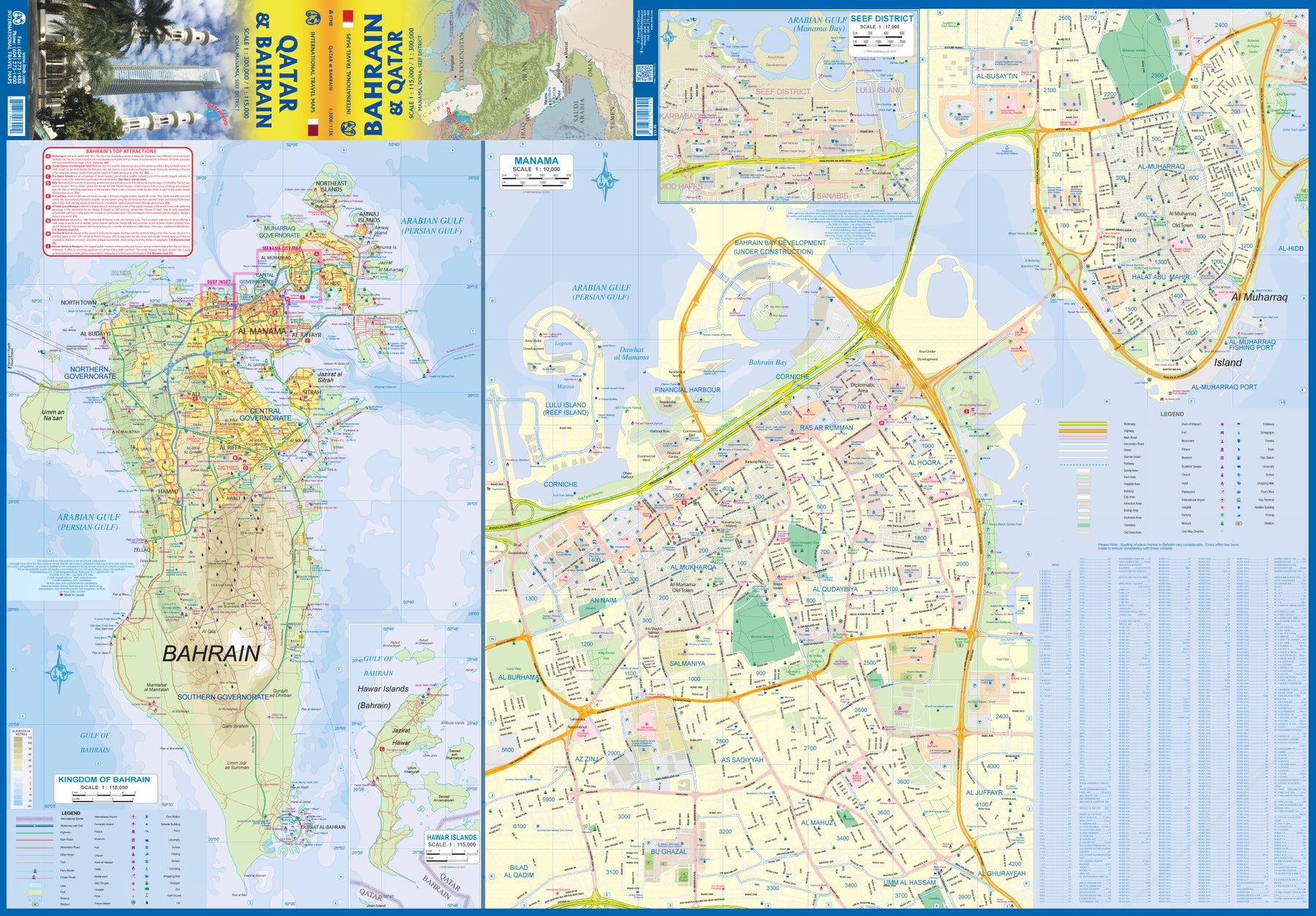
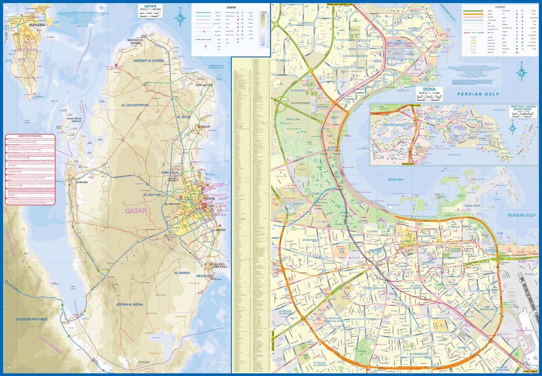
Qatar & Bahrain
Ordinær pris 179,00 krThe northern portion of the United Arab Emirates consists of a small peninsula (Qatar) and an island (Bahrain). Although these countries are not geographically significant in relation to their neighbours, they are enormously wealthy, thanks to oil, and have aspirations of grandeur. Qatar hosted the FIFA World Cup of soccer in November 2022. This is significant. Qatar, as a destination country, is now 'on the map'. Its capital, Doha, is quite well developed, with three Metro subway lines, motorways, and a sophisticated city centre dominated by superb high-rise architecture.
Just to the west, the island of Bahrain is just as wealthy, and just as likely to have ornate architecture, luxurious shopping arcades, and an extravagant lifestyle. Its capital, Manama, is growing very quickly, with large tracts of land being created out of shallow offshore sea areas. It also has Al Mukharqa, the fabulous old town, which is a market souk of narrow roadways to dream for. Both of these countries have been previously published by ITMB, but developments are occurring in both at such a rate that an updated map is essential to get around. This part of the world is fast becoming a desirable vacation centre as well as a business location and a favoured cruise ship destination; Qatar in particular. The map is printed on durable stone paper, as users will need to refer to it frequently to figure out where they are.
Saudi Arabia & Kuwait
Ordinær pris 149,00 krITM har kart over hele verden og de spesialiserer seg på land litt utenfor allfarvei. Beliggenheten til landets nasjonalparker, historiske monumenter, de viktigste veiene o.L. Finner du inkludert i kartene. Samtlige landkart har ofte et bykart over hovedstaden.
Publisert år: 2013
Innbinding: falset
Material: papir
Målestokk: 1:1,750,000 / 1:390,000
Sri Lanka & India South
Ordinær pris 199,00 krThis edition is a considerable improvement on our previous one, benefitting from the extensive research trip we took to the emerald-shaped island shortly before the outbreak of Covid changed the world. We have re-introduced it as a map printed on waterproof paper, as such a format holds up well in a hot, humid climate. We visited all parts of the island and were quite impressed by the number of local hotels and resorts that we found and have added to the map. We were particularly gratified to discover progress on extending the motorway system for the country, much of it now probably delayed due to Covid.
The inset map of Colombo is particularly well-done. The second side of the sheet is a very detailed map of the southern third of India, from Nagpur to the southern tip of the country. Space constraints did not allow for inset maps, but several well-known cities are included – Mumbai, Hyderabad, Chennai, Pondicherry, Madurai, and Bengaluru (Bangalore) among them. India is a fascinating, if somewhat intimidating, place to visit, but is well-worth the time to do so.
Taiwan & Taipei
Ordinær pris 179,00 krThe island of Formosa is friendly, attractively, interesting, safe, and an ideal travel destination. It is also a tad politically contentious, in that mainland China claims it as part of China. Be that as it may, Taiwan is an independent democracy at the moment, with its own government and institutions. Relations between China and Taiwan seem to be benign for the past dozen years or so, and flights from Beijing and Shanghai arrive daily, as do international flights.
Side one concentrates on the capital city of Taipei with an inset map of the extended urban area. The city is a typically crowded Chinese city, with the usual number of exceptionally high office towers (Taipei 101 was the tallest in the world a decade ago). Touristically, the city's main claim to fame is the museum housing the treasures of China brought to the island in 1949, as the Nationalist government led by Chiang Kai Shek moved the capital of China from Chungking (now Chongching), ending the civil war that had convulsed China for decades. The island itself is touristically very interesting.
Side two of the map contains the entire country at a very good scale. One can see at a glance that the western portion is fairly flat and thus is heavily populated, with three motorways joining Taipei to the cities of Taichung, Tainan, and Kaohsiung. An inset map of Tainan is included. I prefer the east coast, which is relatively undeveloped, and the mountainous interior. The road from Hsincheng thorugh the Taroka Gorge is a masterpiece of road construction. The resorts and hot springs of the interior are wonderful relaxing places to enjoy. Sun Moon Lake has several exotic temples and pagodas, and there are nearby aboriginal villages to explore. Further South, for those of an adventuresome inclination, is the port city of Taitung, and ferries to the outlying islands of Lanyu and Green. As will become increasing the case, this map is printed on crushed stone 'paper'. It is waterproof, durable, and tear-resistant.
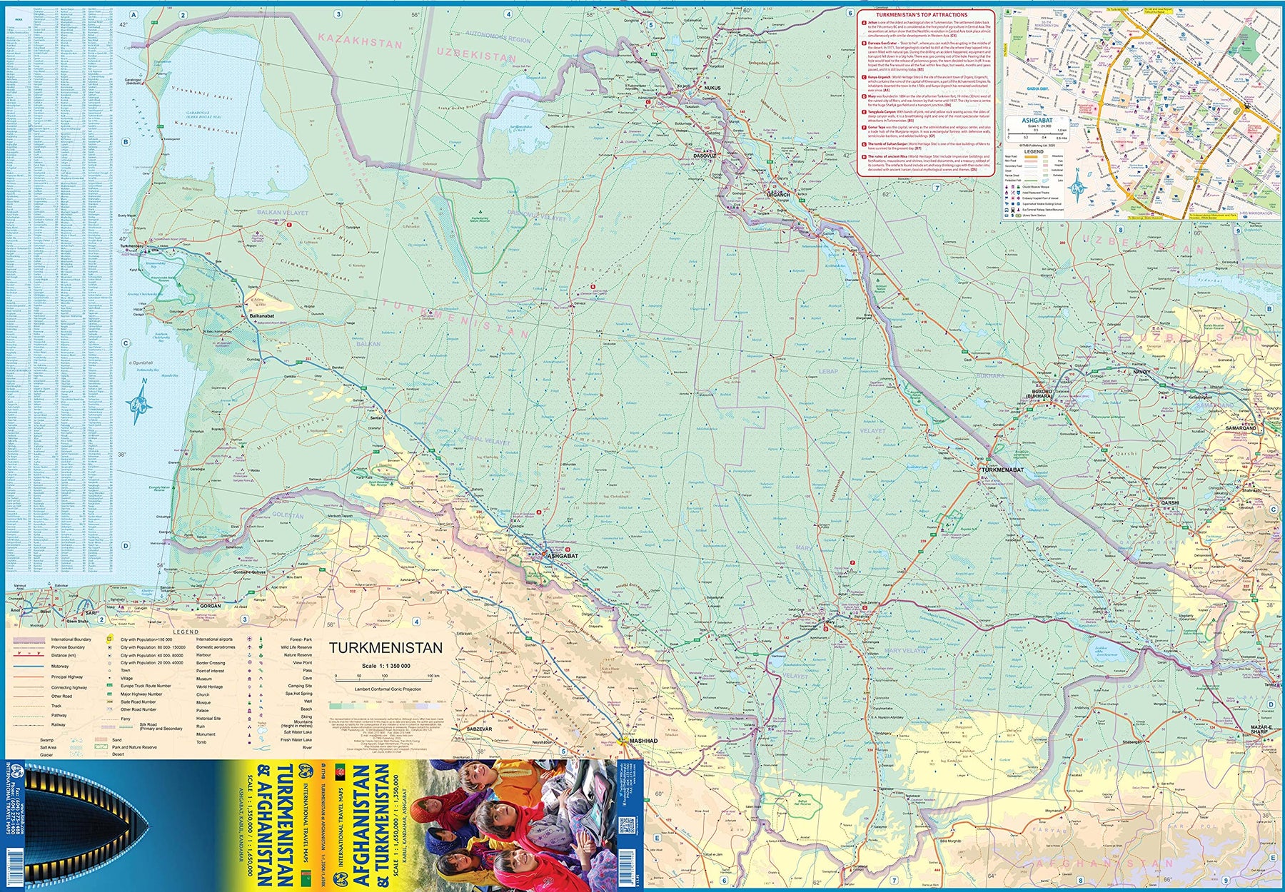
Turkmenistan & Afghanistan
Ordinær pris 179,00 krThe world is changing as a result of a global pandemic, and ITMB has to change with it. We wish to keep all of our artwork available, but at a time of greatly reduced travel, we have been forced to combine two different countries that share a common border in order to justify printing either one. The two countries, Afghanistan and Turkmenistan, do share a common heritage, but a very different history. ITMB Publishes a separate map of the country, and a map of Kabul. The reason for this map is that it is our first ever map of just Turkmenistan, a former part of the USSR that broke away in the collapse of the Russian empire in 1990. The country has, however, not emerged from the Soviet way of thinking, and is authoritarian in its attitude. It is, fortunately, open to travel, and is slowly improving its facilities, so is to be encouraged.
The map includes a very good inset map of Ashgabat, the capital. The country stretches from the Caspian Sea to the Uzbek border and from Russia south to Iran and Afghanistan. We have also added eight Top Attractions, ranging from the World Heritage site of Konye to the ancient ruins of Nisa. We previously published this titles as part of a regional map of the ‘Stans’, but growing demand has justified its own map. We have also published a separate map of Uzbekistan and a separate three-country map of the other three countries, all of which are showing strong signs of touristic development. Turkmenistan is a country emerging as a future travel Mecca. Legend Includes: Roads by classification, Rivers and Lakes, National Park, Airports, Points of Interests, Highways, Main Roads, Zoos, Fishing, and much more...
United Arab Emirates & Abu Dhabi
Ordinær pris 169,00 krITM har kart over hele verden og de spesialiserer seg på land litt utenfor allfarvei. Beliggenheten til landets nasjonalparker, historiske monumenter, de viktigste veiene og lignende finner du inkludert i kartene. Samtlige landkart har ofte et bykart over hovedstaden.
We are pleased to release this brand new ITMB title. Abu Dhabi is one of the leading Emirates that are rapidly becoming vacation heavens for Europeans who don't want the long flights to Asian destinations. The city is so modern it almost squeaks. The palace is a world-class wonder, the seafront Corniche is a marvelous beach, and the central shopping area offers everything from hamburgers to Gucci bags. Motorways now connect the city state to nearby Dubai and to Oman, with a recently-completed one along the coastline to the Saudi border.
The reverse side of the map is an updated edition of the entire United Arab Emirates and most of Oman, with new motorways seemingly everywhere. A large inset map of central Dubai is included, along with a good one of Muscat. We docked at Abu Dhabi's cruise ship terminal during our visit and were impressed by the extent of urbanization of the city.
United Arab Emirates & Dubai
Ordinær pris 169,00 krITM har kart over hele verden og de spesialiserer seg på land litt utenfor allfarvei. Beliggenheten til landets nasjonalparker, historiske monumenter, de viktigste veiene og lignende finner du inkludert i kartene. Samtlige landkart har ofte et bykart over hovedstaden.
Fra ITM: The Sultanate of Dubai is evolving into a popular tourist destination for week-long days. The city itself is fairly new, with lots of exciting architecture, including the man-made resort islands of Deira and Palm Jumeirah. The Burj Khalifa is the tallest building in the world, and the Dubai Mall is the world's largest, with more than 80 million visitors annually. The gold souk is a fascinating traditional market. Truly, the city is making extraordinary efforts to attract visitors from around the world. Equally interesting are the surrounding countries of the United Arab Emirates and Oman, all of which are tourist-friendly. International airports are located close to Abu Dhabi, Dubai, and Muscat. Excellent modern roads connect the entire region and border crossings are relatively routine. This map shows an attractive and interesting part of the world, including such marvels as the Hajar Mountains and Al Ain, one of the world's oldest inhabited cities.
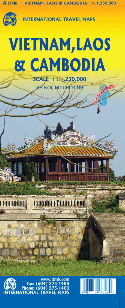
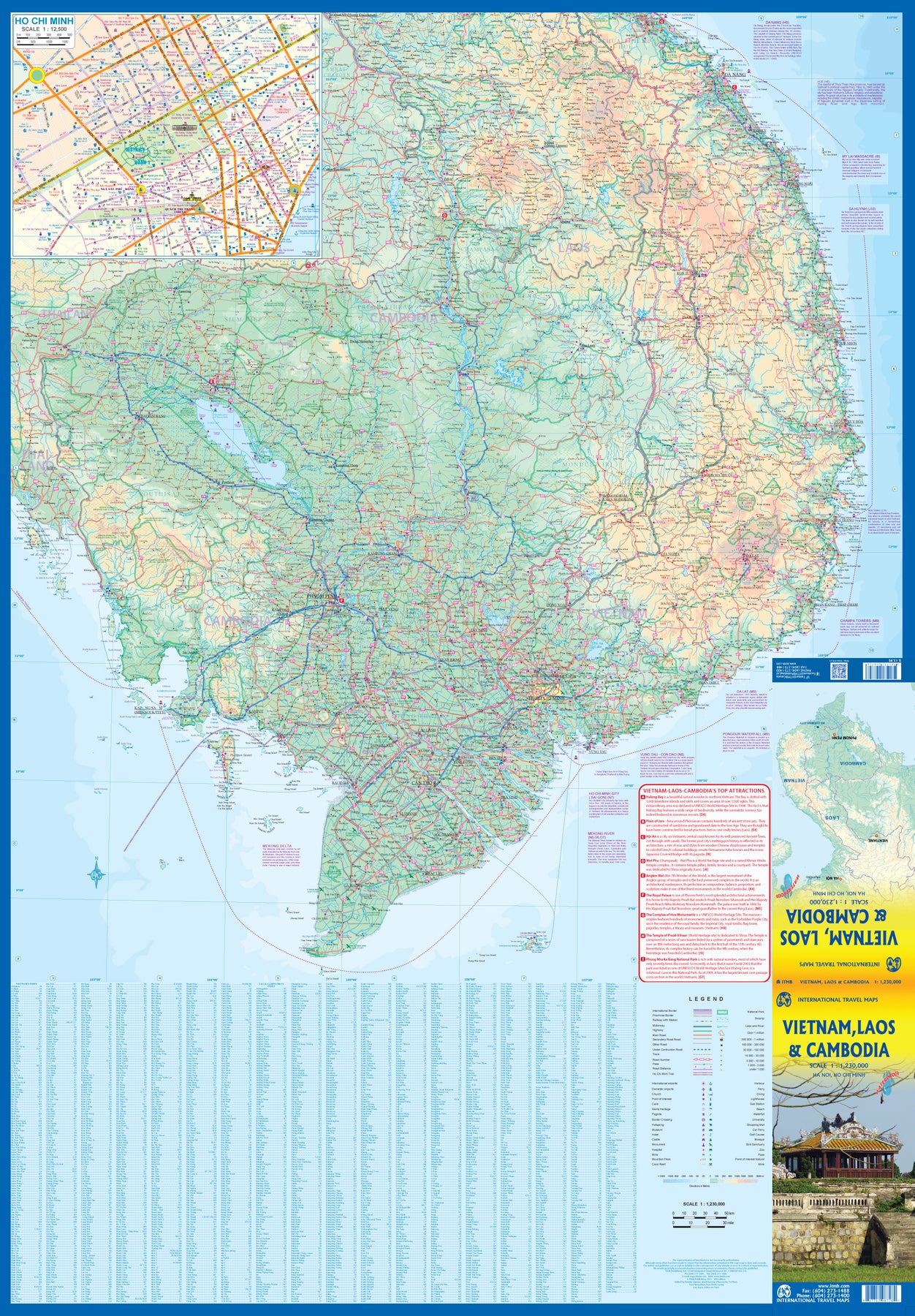
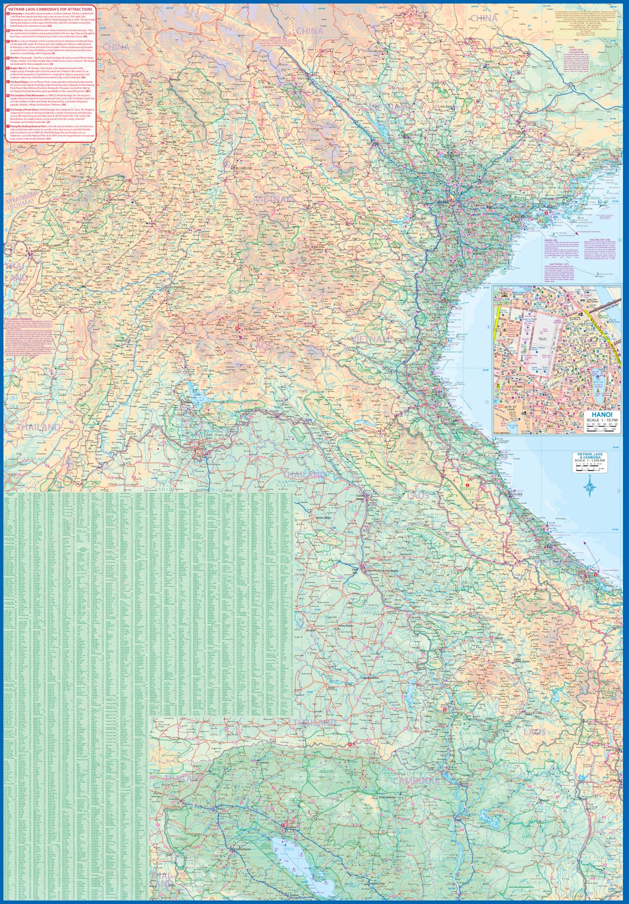
Vietnam, Laos & Cambodia
Ordinær pris 179,00 krThe former French-dominated region of Indochina evolved into three separate countries in the early 1950s. Vietnam, Laos, and Cambodia still retain strong ties and it is easy to travel from one country to another. Each has its particular charm, with a Top Attractions list highlighting the most popular attractions. Side 1 concentrates on the southern portion of the region and includes an inset map of Ho Chi Minh City; the second side covers the area from Sien Riep in Cambodia to the Chinese border areas of both Laos and Vietnam.
An inset map of Hanoi is one this side. The region is prospering after many years of civil unrest, is friendly, safe, and easy to reach since Covid restrictions were removed last year. The new Chinese-built rail line through northern Laos to Chiang Kong in Thailand, and to Vientiane, Laos, is shown for the first time. This line connects with the Chinese rail system leading to Yunnan, but is not shown as the route is still regarded as a military secret by China. At the moment, its purpose is to move freight from China to ports, but it is probable that passenger service is also possible. The map is printed on waterproof stone paper for durability and to hold up in extremely humid conditions.