Filter
- Albania
- Algerie
- Angola
- Argentina
- Australia
- Bahamas
- Bahrain
- Bangladesh
- Barbados
- Belgia
- Benin
- Bhutan
- Bolivia
- Bosnia-Hercegovina
- Botswana
- Brasil
- Brunei
- Bulgaria
- Burundi
- Canada
- Chile
- Dominica
- Frankrike
- Gabon
- Ghana
- Hviterussland
- India
- Kamerun
- Kapp Verde
- Kenya
- Komorene
- Kongo
- Kroatia
- Luxembourg
- Madagaskar
- Malaysia
- Maldivene
- Montenegro
- Mosambik
- Niger
- Rwanda
- Serbia
- Seychellene
- Sierra Leone
- Slovenia
- Somalia
- Sveits
- Sør-Afrika
- Sør-Sudan
- Tanzania
- Zimbabwe
- Østerrike
275 produkter
275 produkter

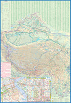
Canada: Manitoba
Ordinær pris 149,00 kr/
Mva inkludert
Frakt beregnes i kassen.
ITM har kart over hele verden og de spesialiserer seg på land litt utenfor allfarvei. Beliggenheten til landets nasjonalparker, historiske monumenter, de viktigste veiene o.L. Finner du inkludert i kartene. Samtlige landkart har ofte et bykart over hovedstaden.
Publisert år: 2009
Innbinding: falset
Material: papir
Målestokk: 1:900000


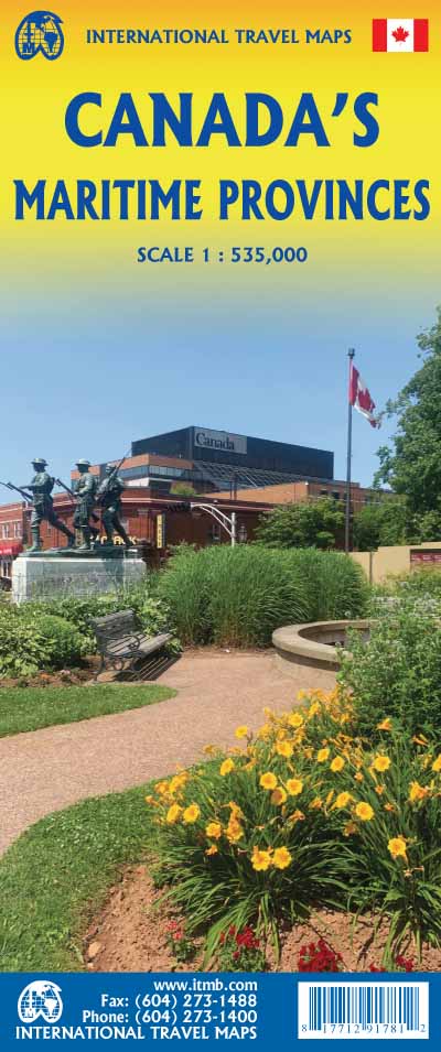
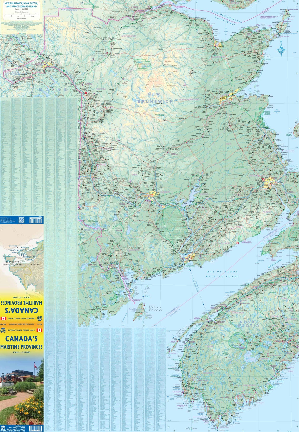
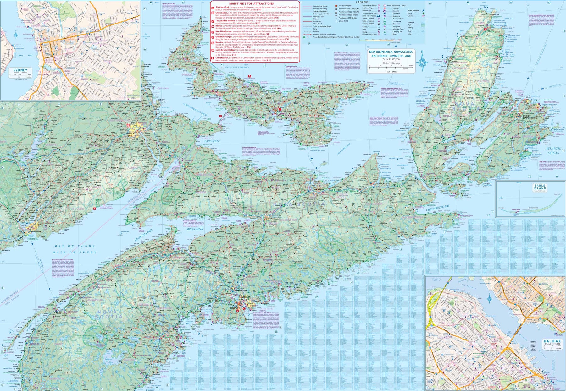
Canada: Maritime Provinces - Nova Scotia; New Brunswick; Prince Edward Island
Ordinær pris 199,00 kr/
Mva inkludert
Frakt beregnes i kassen.
The Atlantic coast of Canada is blessed with some of the earliest European settlement areas in North America. There are three Canadian provinces that have been traditionally called "maritime" - New Brunswick, Nova Scotia, and Prince Edward Island. Newfoundland only became part of Canada in 1949, a century after the term Maritimes had become common usage, so is part of Atlantic Canada, but not the Maritime provinces. This double-sided regional map is great for those visiting all three provinces (ITMB also publishes separate maps of each province).
All the roads and towns are shown, as well as parks, camping areas, touristic attractions, and historic sites. The area is rich in history. Last summer, Lan and I took our two grandchildren on a month-long drive across Canada and visited Louisbourg, on Cape Breton, the French fortress that dominated French control of Quebec for many years. We also toured Green Gables, the actual farm made famous by L. M. Montgomery and her fictional Anne Shirley. Roosevelt's beloved estate is on Campobello Island, in New Brunswick. This is one of the most popular regions of North America to visit.
- Publisert: 2023
- Innbinding: Falset
- Materiale: Papir
- Målestokk: 1:535 000


Canada: Vancouver Island
Ordinær pris 169,00 kr/
Mva inkludert
Frakt beregnes i kassen.
ITM har kart over hele verden og de spesialiserer seg på land litt utenfor allfarvei. Beliggenheten til landets nasjonalparker, historiske monumenter, de viktigste veiene o.L. Finner du inkludert i kartene. Samtlige landkart har et bykart over hovedstaden.
Fra ITM: British Columbia's famous Vancouver Island is one of the great touristic attractions of North America. It hosts the provincial capital at Victoria, Butchart Gardens, the logging museum at Duncan, the painted walls at Chemanus, Long Beach at Tofino, and the Totem poles of Alert Bay. It is linked to the USA by ferries from Seattle and Port Angeles, and by ferries from Vancouver and Powell River, as well as by float planes and airports. About 400,000 people live on the island, but the population expands to over a million during the busy summer season. The island offers something for everyone. All the urban areas are small enough to be easily walkable, hikers revel in the challenges of the West Coast Trail (for which you need a separate map), canoeists can take a week exploring the Broken Islands, and everyone can walk the twelve-mile Long Beach. This is a camper's heaven, with hundreds of wilderness campsites and thousands of kilometers of back road logging routes to explore, mountains to climb, and fiords to boat. No wonder this is such a popular travel destination! Inset maps of Victoria and Tofino are included.
Publisert år: 2019
Innbinding: falset
Material: vanntett papir
Målestokk: 1:270 000

Canada: West Coast Trail & Carmanah Valley
Ordinær pris 169,00 kr/
Mva inkludert
Frakt beregnes i kassen.
ITM har kart over hele verden og de spesialiserer seg på land litt utenfor allfarvei. Beliggenheten til landets nasjonalparker, historiske monumenter, de viktigste veiene o.L. Finner du inkludert i kartene. Samtlige landkart har ofte et bykart over hovedstaden.
Fra ITM: This map is a specialized hiking map of one of the toughest trails in North America. It takes a week to hoof it from Bamfield to Port Renfrew along the western coastline of British Columbia’s West Coast Trail. Hiking the trail is so popular that it is necessary to reserve a start time well in advance of arriving! The trail is contained within a national park, so camping sites are controlled and must be adhered to.
The map has a secondary purpose; it is a recreational map at a detailed scale for anyone wanting to explore the old-growth forests of this part of Vancouver Island. This includes the Broken Islands group, which is also part of the national park, and the Carmanah Valley Provincial Park, home of some of the tallest and oldest trees in the world. By the nature of a rectangular sheet of paper, the map also includes a wealth of logging roads, shorter hikes, whitewater kayaking areas, wilderness campsites, and the canoeing routes of Nitinat Lake. This is truly an amazing adventure map. The artwork is that of the Canada Map Office, with recreational information added by ITMB.
- Publisert: Sept. 2022
- Innbinding: Falset
- Materiale: Papir
- Målestokk: 1:50 000

Canada: Whistler & Sea-to-Sky Highway
Ordinær pris 149,00 kr/
Mva inkludert
Frakt beregnes i kassen.
ITM har kart over hele verden og de spesialiserer seg på land litt utenfor allfarvei. Beliggenheten til landets nasjonalparker, historiske monumenter, de viktigste veiene o.L. Finner du inkludert i kartene. Samtlige landkart har et bykart over hovedstaden.
Publisert år: 2008
Innbinding: falset
Material: papir
Målestokk: 1:185000

Canada: Yukon & British Columbia North
Ordinær pris 169,00 kr/
Mva inkludert
Frakt beregnes i kassen.
ITM har kart over hele verden og de spesialiserer seg på land litt utenfor allfarvei. Beliggenheten til landets nasjonalparker, historiske monumenter, de viktigste veiene o.L. Finner du inkludert i kartene. Samtlige landkart har ofte et bykart over hovedstaden.
Fra ITM: Technically, this is a new map, but in reality it is our map of the Yukon, which has been combined with our map of the Northwest Territories. The reason for combining related mapping areas is well-understood; it makes sense. Canada’s northland is far too vast and far too disparate to show on any map and make sense for those trying to use the map to get around. Starting with Yukon (NB: not “the” Yukon, please), this portion of NWT was carved out into its own territory a century ago, as a result of the gold rush to the Klondike. It is the same map we’ve done since 1989, updated whenever necessary and includes inset maps of Whitehorse (the capital), Dawson City, and Watson Lake. It is still a territory, not a full province, although essentially self-administering. The federal government has just announced a massive infrastructure improvement program to extend and improve roads, but these will take many years to complete.
The NWT side of the sheet shows the brand new all-season gravel road to Tuktoyaktuk on the Arctic Ocean, opening up this part of Canada for land travel for the first time. Much of this roadway had to be built on top of frozen tundra and be built in such a way as to not interfere with cariboo migrations, so was not only a major engineering feat but was designed to minimize environmental disruption. An inset map of Yellowknife (the capital) is included.
- Publisert: Sept. 2022
- Innbinding: Falset
- Materiale: Papir
- Målestokk: 1:400 000, 1:1 000 000


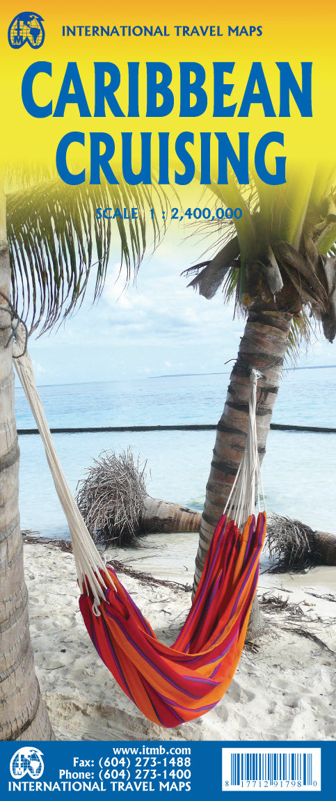
Caribbean Cruising
Ordinær pris 199,00 kr/
Mva inkludert
Frakt beregnes i kassen.
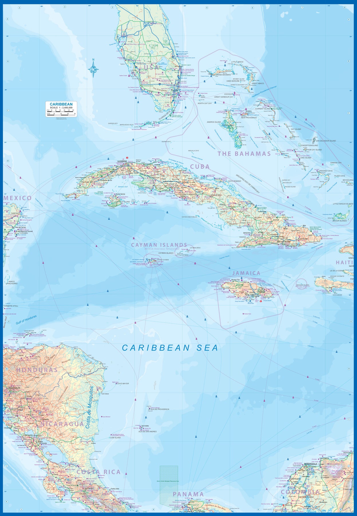
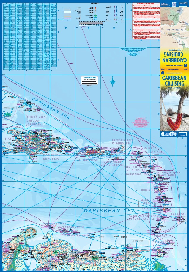
The Caribbean Sea is one of the most popular cruising destinations in the world. This colourful double-sided map starts just north of Orlando/Tampa in order to show the northernmost Bahamian islands and south as far as the Panama Canal at Colon and the coast of Venezuela. The map shows good detail for each island and the legal boundaries of each island nation. Side 1 concentrates on the western Caribbean, essentially the Bahamas, Cuba, Jamaica, and the Cayman Islands. Here's a fun fact most of you won't know: tiny Navassa Island between Haiti and Jamaica is claimed by both the USA and Haiti! Side 2 concentrates on the eastern islands of the Caribbean, such as Hispaniola (Haiti and the Dominican Republic), Puerto Rico and the US and British Virgin Islands, Turks & Caicos, and the Lesser Antilles chain of island countries, such as Antigua, Guadeloupe, Barbados, and Trinidad/Tobago, among others.
Coverage then extends westward along the Venezuelan coastline to include the Dutch possessions of Aruba, Bonaire, and Curacao. Interestingly, there is a small island called Isla Mona west of Puerto Rico on the map that I have never heard of. There are also two Bonaire islands. This is a very interesting map! The most popular cruise line routes are shown; most start either from Puerto Rico or from southern Florida. The map also includes a Top Attractions list, and dozens of local points of interest related to each island.
- Publisert: 2023
- Innbinding: Falset
- Materiale: Papir
- Målestokk: 1:2 400 000

Caribbean Cruising - Aruba; Curacao & Bonaire
Ordinær pris 199,00 kr/
Mva inkludert
Frakt beregnes i kassen.
This is a double-sided map, printed on waterproof stone paper. The Dutch Antilles islands of Aruba, Bonaire, and Curacao are popular Caribbean resort destinations, with pristine beaches, interesting colonial architecture, and even a desert. Settlements like Rincon, on Bonaire, were founded eighty years before Jamestown, in Virginia, and the islands first welcomed Europeans in 1499. As a result, the islands are steeped in a rich history.
This map expands our Caribbean series. Each island is shown in detail, filling one side of the sheet. The other side is filled by our first-ever map of the Caribbean from the Florida Keys and the Bahamas south to the coastline of Venezuela and from Central America east to Barbados. Every cruise ship destination is shown on this map, including one that no cruises will visit. Tiny Navassa Island is a speck of land disputed as to who owns it - Haiti or the USA!
Naturally, all of the island nations well-known to visitors are included, but also lesser-known paradises of the beaten track - for example, Margarita (Venezuela), Cayo Mayor (Honduras), or San Andres (Nicaragua). This map also expands ITMB's growing range of popular cruising maps. This title has two covers, so can be marketed as a Caribbean Cruising map or as a map of three interesting islands.
- Publisert: 2022
- Innbinding: Falset
- Materiale: Vannfast papir
- Målestokk: 1:3 200 000, 1:80 000

Caucasus
Ordinær pris 199,00 kr/
Mva inkludert
Frakt beregnes i kassen.
2nd edition Indexed, double-sided map of the Caucasus region from ITMB with small plans of Yerevan, Baku and Tbilisi, printed on durable waterproof paper. Relief is depicted by altitude tinting, with spot heights for selected peaks. Swamp areas, national parks and reserves are marked, and bathymetric tinting is applied to the sea areas. Georgia scale is 1:430.000 and Azerbaijan/Georgia in 1:650.000.
- Publisert: 2020
- Innbinding: Falset
- Materiale: Papir
- Målestokk: 1:430 000, 1:650 000

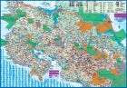
Caucasus: Azerbaijan & Armenia
Ordinær pris 149,00 kr/
Mva inkludert
Frakt beregnes i kassen.
ITM har kart over hele verden og de spesialiserer seg på land litt utenfor allfarvei. Beliggenheten til landets nasjonalparker, historiske monumenter, de viktigste veiene o.L. Finner du inkludert i kartene. Samtlige landkart har ofte et bykart over hovedstaden.
Fra ITM: Armenia and Azerbaijan at 1:430,000 on a double-sided, indexed map from ITMB, with each country accompanied by a street plan of its capital. Diverse ethnography of the region is indicated on an inset.
On one side is Armenia with most of Nagorno-Karabakh, plus the Nakhchivan Autonomous Republic of Azerbaijan and much of Georgia including Tbilisi. The reverse, with a small overlap, is the remainder of Azerbaijan. Topography of the region is shown by altitude colouring in feet, with heights of peaks given in metres (and not in feet as indicated in the map legend). Mountain passes are annotated with months when passable. Swamp areas are marked and national parks or protected areas highlighted. The map shows the region’s road and rail networks, including selected seasonal tracks, and indicates local airports. Symbols highlight various places of interest: historical sites, beaches, winter sport areas, etc. All place names are in the Latin alphabet only. Latitude and longitude lines are drawn at 1° intervals. Each country has a separate index. Street plans of central Yerevan and Baku name main streets and highlight various places of interest including selected foreign embassies. Also provided is an inset showing the distribution of various ethnographic groups.
IMPORTANT - PLEASE NOTE: international and provincial boundaries are not marked precisely enough to give a clear picture of the current political situation in the region, including enclaves and border crossings.
Publisert år: 2016
Innbinding: falset
Material: Papir
Målestokk: 1:430,000

Caucasus: Georgia & Tbilisi
Ordinær pris 199,00 kr/
Mva inkludert
Frakt beregnes i kassen.
Georgia, the country and not the American state, is a very nice, but threatened country of great historical importance. Bordered on the west by the Black Sea, on the north by Russia, and on the east by Azerbaijan, and with an ill-defined border with Turkey on the west, Georgians must be nimble to retain their independence. Only with neighbouring Armenia does Georgia enjoy relatively good relations. Historically, Georgia is a Christian enclave that dates back to the earliest days of Christianity, and its many churches are major touristic attraction.
This map portrays the country as accurately as is possible, showing the expanding network of motorways, major churches, castles, touristic sites, and regrettably, areas of contention with both Russia and Azerbaijan. The reverse side shows a full-sized city map of Tbilisi, the capital. This is the first time that the city has been portrayed in such detail. Attractions include the Narikala Fortress, the cathedral, the old town centre, and the Dry Bridge Market (now a flea market, but in Soviet times a black market). The city lies beside the Kura River, in a valley enclosed by Mtatsminda Mountain, which has two cable cars to its summit, which is now a recreational theme park. The city’s two metro lines are also a good way to travel around the city.
- Publisert: 2022
- Innbinding: Falset
- Materiale: Papir
- Målestokk: 1:600 000 / 1:7000

Chad
Ordinær pris 149,00 kr/
Mva inkludert
Frakt beregnes i kassen.
ITM har kart over hele verden og de spesialiserer seg på land litt utenfor allfarvei. Beliggenheten til landets nasjonalparker, historiske monumenter, de viktigste veiene o.L. Finner du inkludert i kartene. Samtlige landkart har ofte et bykart over hovedstaden.
Publisert år: 2009
Innbinding: falset
Material: papir
Målestokk: 1:1,500,000

Chile: Easter Island & Santiago
Ordinær pris 199,00 kr/
Mva inkludert
Frakt beregnes i kassen.
ITM har kart over hele verden og de spesialiserer seg på land litt utenfor allfarvei. Beliggenheten til landets nasjonalparker, historiske monumenter, de viktigste veiene o.L. Finner du inkludert i kartene. Samtlige landkart har ofte et bykart over hovedstaden.
Fra ITM: 4th edition 2015. Easter Island is so isolated that it is not certain whether it is part of Polynesia or an off-shoot of South America. Geologically, it is neither; just a volcanic lump in the vast expanse of the Pacific Ocean. Its original inhabitants probably came from Polynesia; since supplanted by migrants from Chile, which is the political authority governing the island. Regardless, it is an intriguing place, famous for the Maoi – giant heads originally raised to protect family holdings. These huge, mysterious heads rest in various locations on the island and are one of the wonders of the world. This map also includes a detailed map of Santiago de Chile, the capital of Chile, for the simple reason that all flights to Easter Island originate in that city, so everyone going to Easter Island needs a map of Santiago as well. This usage is merely for the convenience of visitors going to Easter Island.
Publisert år: 2020
Innbinding: falset
Material: papir
Målestokk: 1:24,000 / 12,500

Chile: South & Patagonia
Ordinær pris 199,00 kr/
Mva inkludert
Frakt beregnes i kassen.
ITM har kart over hele verden og de spesialiserer seg på land litt utenfor allfarvei. Beliggenheten til landets nasjonalparker, historiske monumenter, de viktigste veiene o.L. Finner du inkludert i kartene. Samtlige landkart har ofte et bykart over hovedstaden.
Fra ITM: This edition is enhanced by adding a set of ‘must see’ destinations and by the addition of three inset maps: Easter Island (Chile); Ushuaia (Argentina), and the Falkland Islands (UK). The map itself is double-sided, with the entire area of coverage on one side, and a more detailed expansion of southern Chile (south of Puerto Montt) and Easter Island on the other side. I should advise that ITMB publishes more detailed separate maps of Easter Island and of Tierra del Fuego.
- Publisert: 2019
- Innbinding: Falset
- Materiale: Papir
- Målestokk: 1:1:770,000, / 2,200,000


China
Ordinær pris 199,00 kr/
Mva inkludert
Frakt beregnes i kassen.
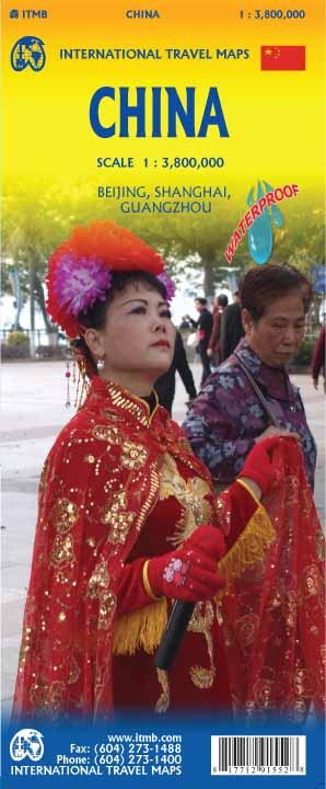
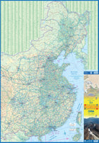
This edition is printed on waterproof, tear-resistant paper, and has a new cover picture showing a portion of the Great Wall. A cursory glance at the map will show an incredible number of motorways. We still show some as being under construction, but updating the road network is now essentially completed. The amazing rapid rail network is now also essentially complete and all such train lines are noted on the map in a red-dashed format. Inset maps of Beijing and Shanghai are shown on side 2, as well as a list of Top Attractions.
We continue to show contentious political disputed territories based on practical administrative control, so India's northeast is shown as being under India's control, whereas parts of the northwest are shown under Chinese control. Taiwan is shown, simply because it is geographically close to mainland China. We do not wish to be drawn into the question of the future status of the island; it is independently operating, as it has been doing since 1949.
- Publisert: 2022
- Innbinding: Falset
- Materiale: Vanntett papir
- Målestokk: 1:3,800 000

China: Shanghai & Southeast
Ordinær pris 169,00 kr/
Mva inkludert
Frakt beregnes i kassen.
ITM har kart over hele verden og de spesialiserer seg på land litt utenfor allfarvei. Beliggenheten til landets nasjonalparker, historiske monumenter, de viktigste veiene og lignende. Finner du inkludert i kartene. Samtlige landkart har ofte et bykart over hovedstaden.
Fra ITM: 4th Edition Although Shanghai is not the largest city in China (that record belongs to Chongching), at 24,000,000 plus people, it is an enormous area. It is one of the best-known of china's mega-cities, situated on the Huangpu River, close to the ocean. The map covers the urban area from the main railway station in the north to the Xuhui area in the south and from East China university campus to the Maglev station in the east. An inset map shows the Maglev route to Pudong International Airport. The touristic core of Shanghai is portrayed in excellent detail. The Bund, along the riverfront, is well-known, all the streets in the Old Town are shown, as is the main shopping district along Nanking Road. Ferry routes along the river are shown, as well as a good selection of hotels. The various rapid transit lines are also shown. The reverse side of the map portrays most of eastern China, from Beijing to Hong Kong to Xi'an in the west. China is evolving quite rapidly and has constructed a complex series of motorways and super-speed train lines in recent years. These are all shown in very good detail. The map also includes the island of Taiwan, claimed by China, but independent. The regional map covers the area of interest for the vast majority of visitors to China, including two dozen mega-cities of more than 5 million people each.
- Publisert: 2021
- Innbinding: Falset
- Materiale: Plastpapir
- Målestokk: 1:16,000 / 1:2,500,000

China: South
Ordinær pris 149,00 kr/
Mva inkludert
Frakt beregnes i kassen.
ITM har kart over hele verden og de spesialiserer seg på land litt utenfor allfarvei. Beliggenheten til landets nasjonalparker, historiske monumenter, de viktigste veiene o.L. Finner du inkludert i kartene. Samtlige landkart har ofte et bykart over hovedstaden.
Fra ITM: 1st edition October 2015. This map in scale 1:3 mio. concentrates on the part of China from Shanghai south and all the way west to Lhasa and includes Taiwan and Hainan Island. We are not trying to make any sort of political comment here, but geographically, both Tibet and Taiwan fall within the area of coverage and are both included for this reason alone. Inset maps of Hong Kong, Guangzhou (1:850.000) and Shanghai. Legend Includes: Roads by classification, Points of Interest, National Parks, Airports, Golf Courses, Beaches, Campsites, Waterfalls, Viewpoints, Churches, Surfing/Scuba Diving Spots, Fishing Spots, Hospitals, harbours/Ports, Lighthouses, Museums, Monuments, Caves, Mosques, Mountain Peaks, Botanic Gardens, Wildlife Sanctuary, Zoos, Sports Fields, and much more.
Publisert år: 2015
Innbinding: falset
Material: Plastpapir
Målestokk: 1:3000000

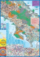
China: South & Guangzhou
Ordinær pris 149,00 kr Salgspris 119,00 kr Spar 20%/
Mva inkludert
Frakt beregnes i kassen.
China, as a country, is very popular with travellers. However, China is also a very large geographical entity and showing the entire country on one map results in a scale that reduces the amount of information that can be shown. The most visited part of the country is the south, with rapid train access from Hong Kong and major airports at Guangzhou and Shanghai. Travel to China is also increasing as more international airports are opened. The regional map covers one side of this double-sided map; the other contains an updated map of Guangzhou (formerly Canton). Lan and I visited this city in February and were surprised at how open and modern the city is. In comparison with Beijing, the political overtones are much reduced, and Sun Yat Sen is the hero. The city is also a major train hub, with two major stations handling traffic, and six bus stations arranging transportation to nearby cities.
- Publisert: 2015
- Innbinding: Falset
- Materiale: Papir
- Målestokk: 1:3 000 000, 1:15 000

Colombia
Ordinær pris 149,00 kr/
Mva inkludert
Frakt beregnes i kassen.
ITM har kart over hele verden og de spesialiserer seg på land litt utenfor allfarvei. Beliggenheten til landets nasjonalparker, historiske monumenter, de viktigste veiene og lignende finner du inkludert i kartene. Samtlige landkart har ofte et bykart over hovedstaden.
Fra ITM: Colombia is developing into one of the best touristic destinations in South America. It is easy to reach from North America and has invested heavily as a country in promoting tourism. We have been in the country twice since the last edition of our map was published, so this edition benefits from a wealth of new information and features. The map is printed on plastic waterproof paper for both durability and for standing up to usage in a humid tropical country. As a new feature, we have added a listing of the top attractions of Colombia, such as the salt cathedral of Zipaquira, the gold museum in Bogota (a must-see!!), and the Castilla overlooking Cartagena. The map includes excellent inset maps of Bogota, Cartagena, and Cali, as well as inset maps of San Andreas and Providencia Islands. Colombia is working hard to catch up on a huge backlog of infrastructural development, so expect to see road crews hard at work making all our updated highway information obsolete! It’s nice to see this beautiful country emerging as a revitalized powerhouse.
- Publisert: 2018
- Innbinding: Falset
- Materiale: Vanntett papir
- Målestokk: 1:1 300 000


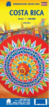
Costa Rica
Ordinær pris 179,00 kr/
Mva inkludert
Frakt beregnes i kassen.
This is an ITMB title that is so popular it needs no explanation. This is the most recent edition of a tried-and true title that has been a mainstay of our Central American line since the early 1980s. Folded double-sided road map Inset maps: Central San Jose City, Environs of San Jose , List of Costa Rica's Top Attractions. Legend includes: Highways, roads, railways, lakes, rivers, national parks, hotels, gas stations, museums, beaches, waterfalls and more.
- Publisert: 2022
- Innbinding: Falset
- Materiale: Plastpapir
- Målestokk: 1:300 000