Filter
- Albania
- Algerie
- Angola
- Argentina
- Australia
- Bahamas
- Bahrain
- Bangladesh
- Barbados
- Belgia
- Benin
- Bhutan
- Bolivia
- Bosnia-Hercegovina
- Botswana
- Brasil
- Brunei
- Bulgaria
- Burundi
- Canada
- Chile
- Dominica
- Frankrike
- Gabon
- Ghana
- Hviterussland
- India
- Kamerun
- Kapp Verde
- Kenya
- Komorene
- Kongo
- Kroatia
- Luxembourg
- Madagaskar
- Malaysia
- Maldivene
- Montenegro
- Mosambik
- Niger
- Rwanda
- Serbia
- Seychellene
- Sierra Leone
- Slovenia
- Somalia
- Sveits
- Sør-Afrika
- Sør-Sudan
- Tanzania
- Zimbabwe
- Østerrike
318 produkter
318 produkter
Utsolgt
Belgium & Luxembourg
ITM
149,00 kr
Utsolgt
Bolivia
ITM
149,00 kr
Utsolgt
Brazil
ITM
189,00 kr
Utsolgt
Cameroon & Gabon
ITM
149,00 kr
Utsolgt
Canada
ITM
149,00 kr

Bangladesh & India East
Ordinær pris 149,00 kr/
Mva inkludert
Frakt beregnes i kassen.
ITM har kart over hele verden og de spesialiserer seg på land litt utenfor allfarvei. Beliggenheten til landets nasjonalparker, historiske monumenter, de viktigste veiene o.L. Finner du inkludert i kartene. Samtlige landkart har ofte et bykart over hovedstaden.
Fra ITM: Bangladesh at 1:750,000 on an indexed map from ITM, with street plans of central Dhaka and Chittagong, plus on the reverse a road map of north-eastern India with a street plan of Kolkata plus an enlargement of the city’s environs.
On one side is an indexed map of Bangladesh at 1:750,000. Distances are shown on main roads and railway lines are included. The map also shows administrative borders with names of the provinces. Town names are annotated with icons indicating that facilities and/or places of interest can be found there. The map also highlights various other interesting sites. Latitude and longitude lines are drawn at 30’ intervals. The map is accompanied by street plans of central Dhaka and Chittagong, highlighting various facilities and places of interest, plus notes about the country, etc.
On the reverse is an indexed road map of North-Eastern India and eastern Nepal at 1:1,500,000, extending in India south-west to Sambalpur and Bhubaneshwar and within Nepal west to Pokhara. Please note that coverage of Bangladesh on that side of the map is incomplete, with the central part of the country blocked by the index. The map shows the regions road and rail connections, local airports, state boundaries, and various places of interest. Topography is indicated by altitude colouring in feet, although peak heights are given in metres. Latitude and longitude lines are drawn at 1°intervals. An enlargement shows the environs of Kolkata (Calcutta) in greater detail, and also included is a street plan of central Kolkata highlighting important buildings, various facilities, etc.
Publisert år: 2013
Innbinding: falset
Material: papir
Målestokk: 1:1500000


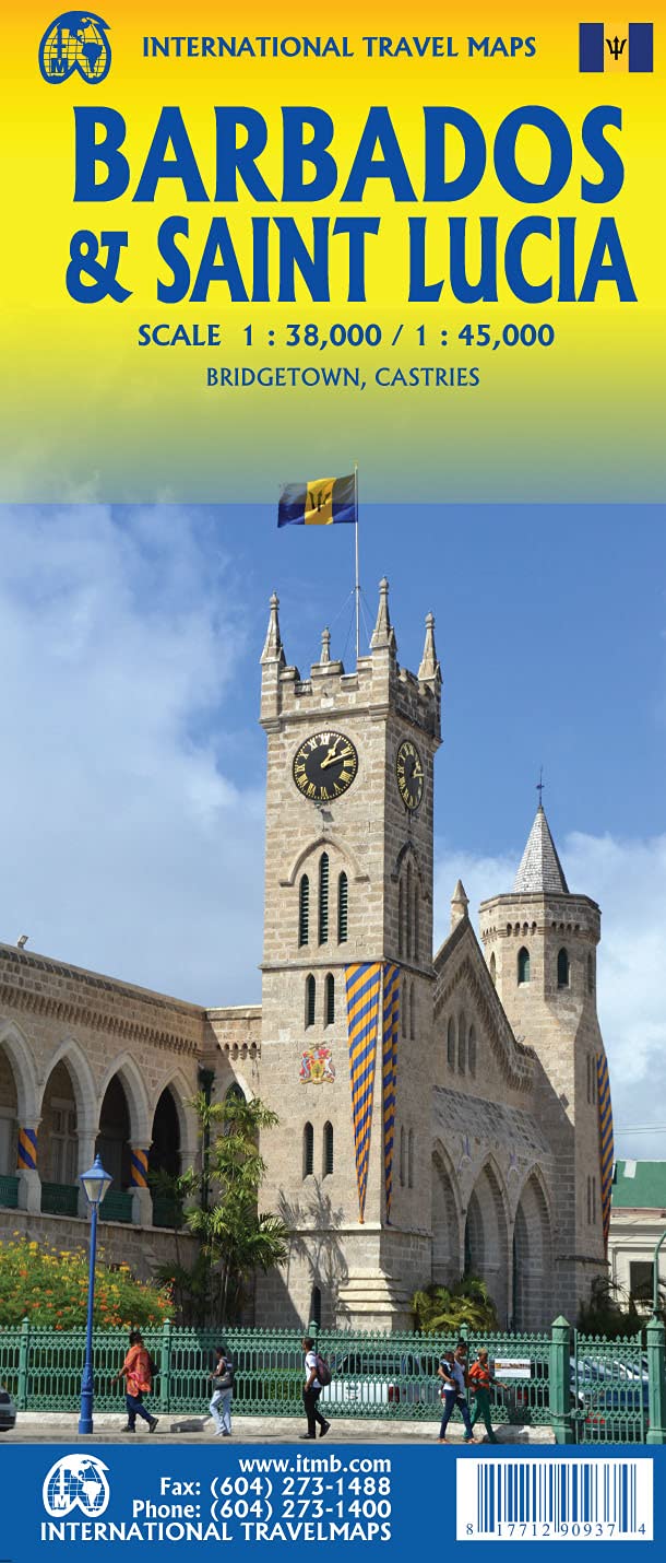


Barbados & Saint Lucia
Ordinær pris 189,00 kr/
Mva inkludert
Frakt beregnes i kassen.
ITM har kart over hele verden og de spesialiserer seg på land litt utenfor allfarvei. Beliggenheten til landets nasjonalparker, historiske monumenter, de viktigste veiene o.L. Finner du inkludert i kartene. Samtlige landkart har ofte et bykart over hovedstaden.
Fra ITM: Barbados and St. Lucia are adjacent Caribbean islands and are touristically important in their own rights, but are also frequently visited on the same cruise trip by a variety of cruise ship lines. Saint Lucia fills side 1 as one opens the map, with a comprehensive inset map of Castries, the capital. The interior of the mountainous island is mostly a rain forest and is largely inaccessible. The island has two airports and one cruise ship dock (at Castries) that provides access to inter-island ferries from St. Vincent, Barbados, Martinique, Dominica, and Guadeloupe, so the island is readily accessible internationally. Clusters of resorts abound at Marigot, Rodney Bay, Soufriere, and Vieux Port. A good highway links the far north to the far south. The other side of the sheet covers Barbados in fantastic detail, with an excellent inset map of Bridgetown, the capital. The island’s airport is east of the capital, and the focus for resorts is at St. Lawrence Gap, on the south coast, with another along the west coast, at Holetown. This island is more gently rolling countryside, with several scenic routes through and around the island. We have also included a Ten Top Attractions, including Sunbury Plantation (1660), St. Nicolas Abbey (1658), and Gun Hill Signal Station (1818). Both islands are loaded with history, attractions, and wonderful weather.
Publisert: Aug. 2021
Innbinding: falset
Material: vanntettpapir
Målestokk: 1:38,000/1:45,000

Belarus
Ordinær pris 149,00 kr/
Mva inkludert
Frakt beregnes i kassen.
ITM har kart over hele verden og de spesialiserer seg på land litt utenfor allfarvei. Beliggenheten til landets nasjonalparker, historiske monumenter, de viktigste veiene o.L. Finner du inkludert i kartene. Samtlige landkart har ofte et bykart over hovedstaden.
Fra ITM: 2nd edition October 2015. Folded map with detailed road and rail network, National Parks and Reserves with complete index of all cities and towns in the map. In this edition, major urban areas are shown in Cyrillic as well as the Latin alphabet, hypsometry has been re-worked to show elevation differences better. This is a double-sided map of the country (divided into west and east halves) with part of Lithuania on the western part and a fair amount of Russia on the eastern side. Known international border crossings are shown, except on crossing into Russia, which are numerous. A large inset map for Minsk in a very suitable scale (1:15.000 Scale) comprising most of the touristic sights and places of interest and Metro lines has also been provided that is far better than what we could show previously.
Publisert år: 2015
Innbinding: falset
Material: papir
Målestokk: 1:600000


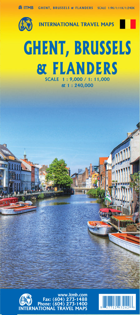
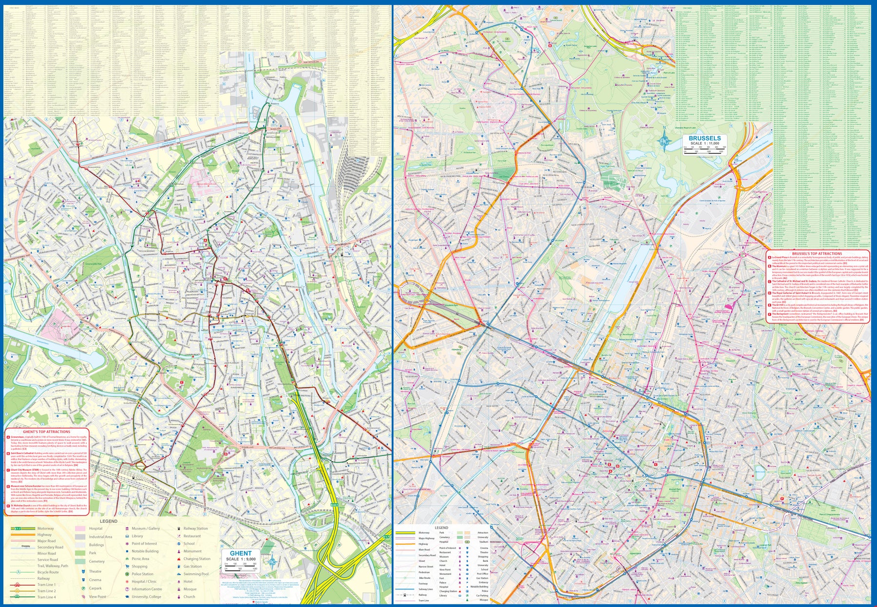
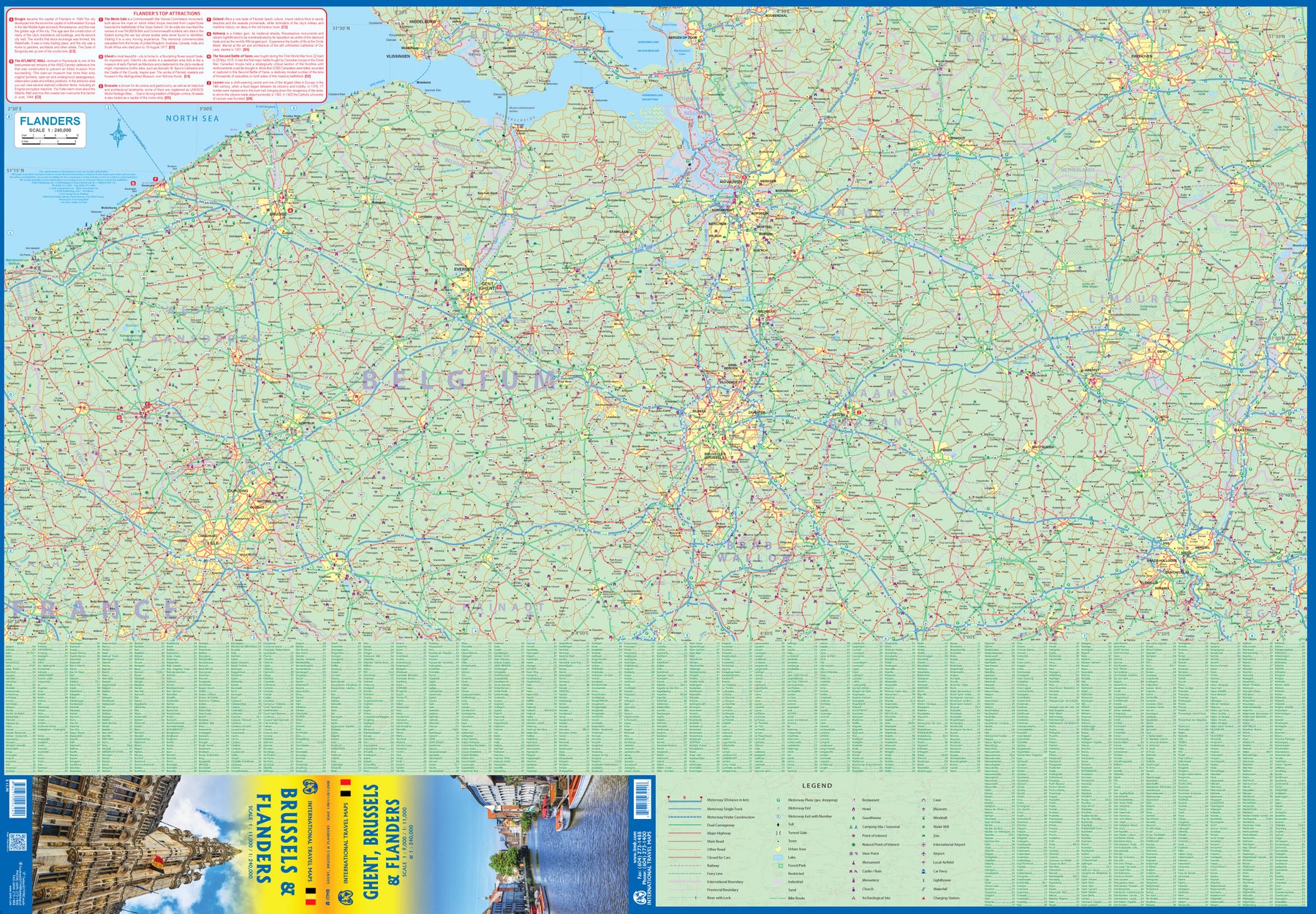
Belgium: Ghent; Brussels & Flanders
Ordinær pris 179,00 kr/
Mva inkludert
Frakt beregnes i kassen.
Ghent is one of the most historic cities in Europe. A city of canals, it became wealthy during the Middle Ages by controlling the production of cloth over several centuries. It is full of historic buildings and desperately needs a map or one becomes lost in the narrow streets that fill the ancient city centre. However, Ghent is not all that big so we have combined it with a detailed map of Brussels, the nominal capital of Belgium and the location of the European Union HQ. It was also the site of the famous world fair in 1968, the legacy of which is the Giant Atomium.
Side 2 of the map is also a new venture for us; a detailed map of Flanders region from Liege to Lille and from south of Brussels to north of Antwerp. This portion of both France and Belgium is full of historical importance and we hope to develop this artwork in future editions. For now, it is a detailed road map showing many fortresses/castles and monuments.
- Publisert: 2023
- Innbinding: Falset
- Materiale: Papir
- Målestokk: 1:9 000. 1:11 000, 1:240 000


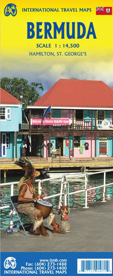
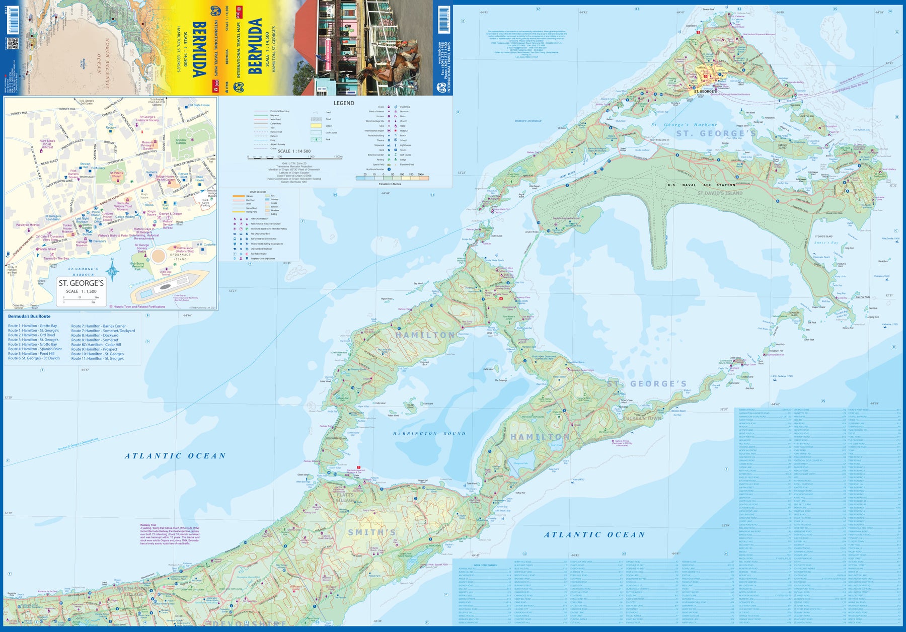
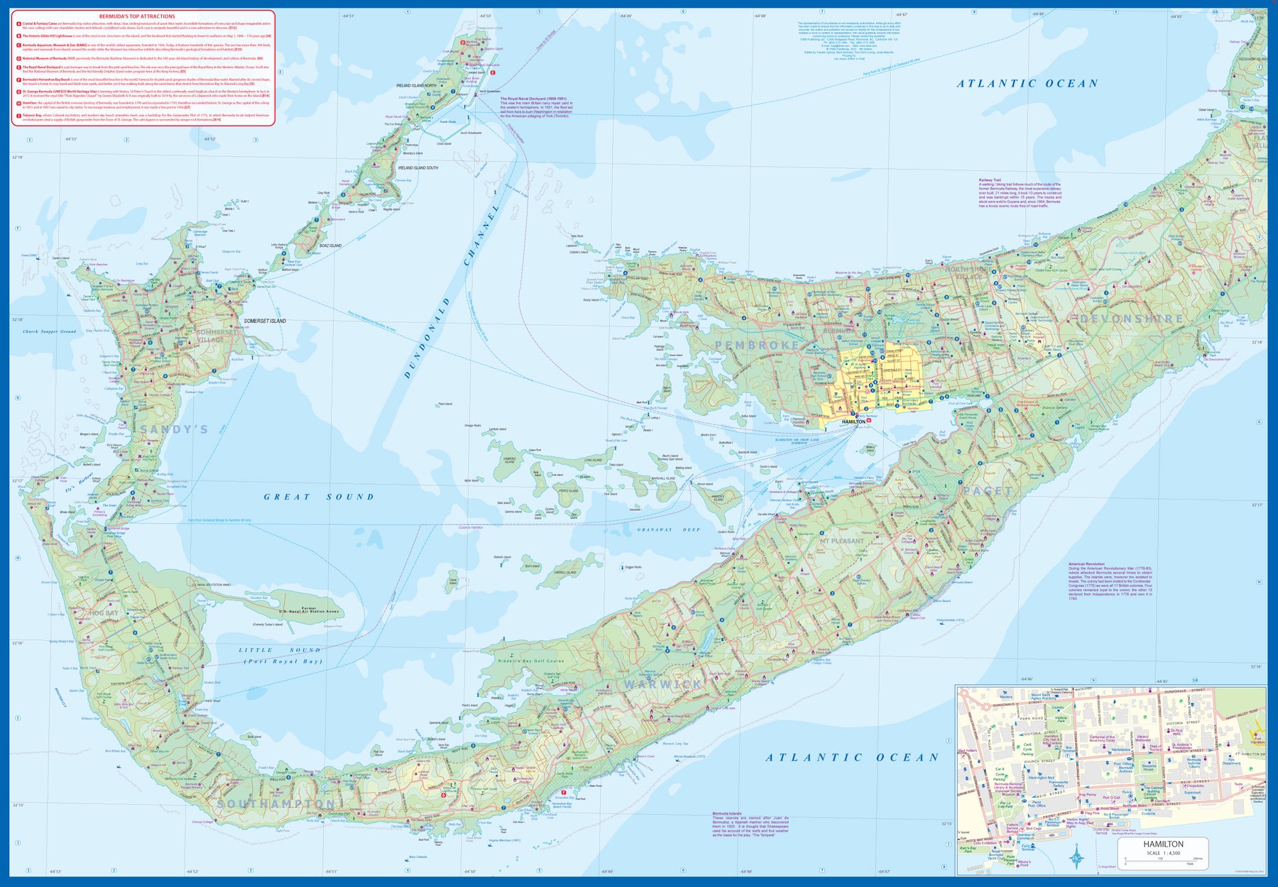
Bermuda
Ordinær pris 179,00 kr/
Mva inkludert
Frakt beregnes i kassen.
Bermuda is a lovely mid-Atlantic island far off the coast of South Carolina. It is full of colonial architecture and an ‘island’ way of life. Tourism is a key ingredient of the colony’s lifeblood and the island is very popular with cruise ships. There is ample accommodation for longer-term visitors, good roads, and much history. The airport was built by the US Navy during WW2 and is still a US Naval Air Station, but shares the runway with civil aviation.
The map includes an excellent inset of St. George’s, which still has its stocks close to the town hall, and another of Hamilton, the capital. This is where most cruise ships dock. For those with the time, the map shows the Railway Trail along the former route of the island’s now-defunct rail line. Lots to see; lots to do!
- Publisert: 2023
- Innbinding: Falset
- Materiale: Papir
- Målestokk: 1:14 500

Borneo: Sarawak; Sabah & Brunei
Ordinær pris 149,00 kr/
Mva inkludert
Frakt beregnes i kassen.
ITM har kart over hele verden og de spesialiserer seg på land litt utenfor allfarvei. Beliggenheten til landets nasjonalparker, historiske monumenter, de viktigste veiene o.L. Finner du inkludert i kartene. Samtlige landkart har ofte et bykart over hovedstaden.
Publisert år: 2012
Innbinding: falset
Material: papir
Målestokk: 1:620000

Botswana & Zimbabwe
Ordinær pris 189,00 kr/
Mva inkludert
Frakt beregnes i kassen.
ITM har kart over hele verden og de spesialiserer seg på land litt utenfor allfarvei. Beliggenheten til landets nasjonalparker, historiske monumenter, de viktigste veiene og lignende finner du inkludert i kartene. Samtlige landkart har ofte et bykart over hovedstaden.
Fra ITM: 7th Edition 1:1,600,000/11:1,000,000 on waterproof stone paper
Both Botswana and its neighbour, Zimbabwe, form a common entity and a British heritage in Central Southern Africa, but there the resemblance ends. The Bechuana formed an alliance of sorts with the Pritish to protect them from the Boers in the then-nearby Transvaal. Upon a peaceful transition to independence as Botswana, it has evolved into a democratic and peaceful country. Zimbabwe, formerly Rhodeisa, is a failed state, although potentially, Zimbabwe could dominate tourism if governmental affairs were orderly. This map focuses on Botswana simply because that country is a beacon of orderly pleasantness in the continent; well run, routistacally well developed, with good infrastructure, and close to the game preserves of both South Africa and Zimbabwe. The map includes a large inset map of Gaborone, the capital, but most visitors fly into Maun, in the north, which is close to the country's greatest assets, the Okavango Delta, home of one of the greatest wildlife preserves on earth. Personally, I prefer the central Kalahari Desert area, because it is so unique, but wildlife viewing is the source of the country's top rating as a tourist destination. To the west is Namibia, another country that has evolved into a sensible independent country, and to the east and south is South Africa. One can enter Zimbabwe at Kazanula or at Plumtree, to visit Victoria Falls, one of the great physical attractions of Africa. The second side of our maps shows this country in great detail, and having lived in the country for several years, I can attest to its attractiveness. Inset maps of Harare, the capital, Bulawayo, Victoria Falls, and the Great Zimbabwe Ruins make this map essential for anyone visiting this country. A word of caution must be fiven here, in that the condition of many of the roads has deteriorated overtime, petrol is often unavailable, and basic foodstuffs are costly. The map has been printed on durable tear-resistant stone paper, and should outlast any visit.
Both Botswana and its neighbour, Zimbabwe, form a common entity and a British heritage in Central Southern Africa, but there the resemblance ends. The Bechuana formed an alliance of sorts with the Pritish to protect them from the Boers in the then-nearby Transvaal. Upon a peaceful transition to independence as Botswana, it has evolved into a democratic and peaceful country. Zimbabwe, formerly Rhodeisa, is a failed state, although potentially, Zimbabwe could dominate tourism if governmental affairs were orderly. This map focuses on Botswana simply because that country is a beacon of orderly pleasantness in the continent; well run, routistacally well developed, with good infrastructure, and close to the game preserves of both South Africa and Zimbabwe. The map includes a large inset map of Gaborone, the capital, but most visitors fly into Maun, in the north, which is close to the country's greatest assets, the Okavango Delta, home of one of the greatest wildlife preserves on earth. Personally, I prefer the central Kalahari Desert area, because it is so unique, but wildlife viewing is the source of the country's top rating as a tourist destination. To the west is Namibia, another country that has evolved into a sensible independent country, and to the east and south is South Africa. One can enter Zimbabwe at Kazanula or at Plumtree, to visit Victoria Falls, one of the great physical attractions of Africa. The second side of our maps shows this country in great detail, and having lived in the country for several years, I can attest to its attractiveness. Inset maps of Harare, the capital, Bulawayo, Victoria Falls, and the Great Zimbabwe Ruins make this map essential for anyone visiting this country. A word of caution must be fiven here, in that the condition of many of the roads has deteriorated overtime, petrol is often unavailable, and basic foodstuffs are costly. The map has been printed on durable tear-resistant stone paper, and should outlast any visit.
- Publisert: 2020
- Innbinding: Falset
- Materiale: Vanntett papir
- Målestokk: 1:1 600 000, 1:1 100 000

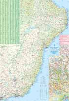
Brazil: Amazon & Brazil North
Ordinær pris 199,00 kr/
Mva inkludert
Frakt beregnes i kassen.
We first mapped the Amazon River Basin for a rainforest protection conference many years ago, preparing what we thought was a pretty good rendition until we arrived at a conference full of experts who were able to add so much more data that we re-did the map before publishing it. We have updated it repeatedly as more information has come to light and are pleased to release this sixth version, which does something that we have wanted to do for some time - it adds a detailed map of the northern half of Brazil/Brasil to a river map that covers portions of seven different countries.
The map is printed on revolutionary stone paper (tear-resistant, waterproof, friendly to the environment, and bio-degradable as well as extremely durable), and has two different cover pictures, so it can be marketed either as a map of Brasil or of the Amazon Basin - or both! It is also the only map of the river basin in print. As the world emerges from the era of Covid, this part of the world will once again dominate demand for South American explorers.
- Publisert: Mars 2022
- Innbinding: Falset
- Material: Vannfast papir
- Målestokk: 1:3 000 000


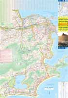
Brazil: East Coast - Rio de Janeiro
Ordinær pris 169,00 kr/
Mva inkludert
Frakt beregnes i kassen.
ITM har kart over hele verden og de spesialiserer seg på land litt utenfor allfarvei. Beliggenheten til landets nasjonalparker, historiske monumenter, de viktigste veiene og lignende finner du inkludert i kartene. Samtlige landkart har ofte et bykart over hovedstaden.
Fra ITM: We are pleased to re-introduce our popular map of Rio for its third edition, and to include with it a detailed map of the south and east coasts of Brasil. Rio is a fascinating city. It recently hosted the Olympics and promised much in the way of infrastructural improvements. The core of the map is the Carioca region, close to the lower end of the tram line to the favelas. However, arriving visitors can now take the new subway from the airport to the city centre or south to the beach communities of Copacabana, Ipanema, and Leblon. The other side of the map covers much of developed Brasil, stretching from Sao Paulo in the lower left corner to Natal in the upper right of the sheet. It goes inland to Belo Horizonte and north along ordinary roads to Teresina on the Parnaiba River. The coastal highway through Salvador and Recife passes innumerable beaches and historic towns. Natal is a very popular beach area, with direct flights from Portugal. Altogether, an interesting map.
- Publisert: 2019
- Innbinding: Falset
- Materiale: Vanntett papir
- Målestokk: 1:2 200 000, 1:12 900

Brazil: South & East Coast
Ordinær pris 149,00 kr/
Mva inkludert
Frakt beregnes i kassen.
ITM har kart over hele verden og de spesialiserer seg på land litt utenfor allfarvei. Beliggenheten til landets nasjonalparker, historiske monumenter, de viktigste veiene o.L. Finner du inkludert i kartene. Samtlige landkart har ofte et bykart over hovedstaden.
Fra ITB: Brasil is such a large country that it needs two maps to cover it adequately. This map covers the country from the southernmost point to Sao Luis on the northern coast and inland as far as Brasilia. Scale 1:2,2 mio. This is where 80% of the country lives and where 95% of the tourists visit. The interior and Amazon region will be covered separately. This map includes separate inset maps of both Rio and Sao Paulo and shows the extensive motorway network of Brasil to good advantage. The top attractions of the region are noted, such as Iguazu Falls, Sugar Loaf, Brasilia, and Salvador.
Publisert år: 2018
Innbinding: falset
Material: Papir
Målestokk: 1:2200000

Bulgaria Railway & Road
Ordinær pris 169,00 kr/
Mva inkludert
Frakt beregnes i kassen.
ITM har kart over hele verden og de spesialiserer seg på land litt utenfor allfarvei. Beliggenheten til landets nasjonalparker, historiske monumenter, de viktigste veiene o.L. Finner du inkludert i kartene. Samtlige landkart har ofte et bykart over hovedstaden.
Fra ITM: We spent a week in Bulgaria in 2019, driving the roads, staying in towns around the country, and visiting attractions. The result of all this effort was to update our data for a new map of Bulgaria. This is a country that has been transformed by its entry into the European Union. Touristically, the country has benefitted by new investments in resort accommodations and by improvements to touristic attractions. The country is quite affordable to visit, the people are friendly, the weather is pleasant, the roads are generally very good, and accommodations are equal to other parts of Europe. We have changed the name somewhat to place an emphasis on rail travel. In concert with changing travel patterns, Bulgaria is renovating its passenger rail service, so we have included all lines carrying passengers. We have also updated the motorway network of the country. We have added a Top Attractions list to the artwork, and have updated the large inset map of Sofia. Provincial boundaries have not been included, as these are mostly local administrations, but the names have been included, as they are commonly used within the country.
- Publisert: 2020
- Innbinding: Falset
- Målestokk: 1:390 000
- ISBN: 9781771290982

Burkina Faso & Niger
Ordinær pris 149,00 kr/
Mva inkludert
Frakt beregnes i kassen.
ITM har kart over hele verden og de spesialiserer seg på land litt utenfor allfarvei. Beliggenheten til landets nasjonalparker, historiske monumenter, de viktigste veiene o.L. Finner du inkludert i kartene. Samtlige landkart har ofte et bykart over hovedstaden.
Fra ITM: Burkina Faso and Niger on a double-sided, indexed map from ITMB, presenting each country separately at 1:1,000,000 1:1,950,000 respectively and accompanied by street plans of Ouagadougou, Bobo-Dioulasso and Niamey. Altitude colouring shows the topography (with bands in feet in Burkina Faso and in metres in Niger). In Burkina Faso the map indicates areas of periodic inundation, whilst in Niger numerous water wells, salt pans, sand dunes and lava fields are also marked. In both countries parks and nature reserves are highlighted.
Road network indicates seasonal roads and shows locations of fuel supplies and border crossings, plus distances on main routes. Airports and aerodromes for small craft are marked; towns are annotated with symbols indicating what facilities can be found there. Each map has latitude and longitude lines (at 1° in Burkina Faso and 2° in Niger), plus a separate index.
Street plans, annotated with names of hotels, various tourist facilities and main buildings cover Ouagadougou (with an enlargement for the town cente), Bobo-Dioulasso and Niamey.
Publisert år: 2013
Innbinding: falset
Material: papir
Målestokk: 1:1950000

Cambodia & Mekong Delta
Ordinær pris 169,00 kr/
Mva inkludert
Frakt beregnes i kassen.
ITM har kart over hele verden og de spesialiserer seg på land litt utenfor allfarvei. Beliggenheten til landets nasjonalparker, historiske monumenter, de viktigste veiene o.L. Finner du inkludert i kartene. Samtlige landkart har ofte et bykart over hovedstaden.
Fra ITM: Tourism to Cambodia is growing so quickly that we felt it necessary to bring back the country as its own map, instead of being combined with Laos. However, the entire country fits very nicely on one side of a map sheet, so we have combined it with neighbouring Vietnam’s Mekong Delta map. There are two treasures in Cambodia: the Angkor Wat complex of temples near Siem Riep, and the capital of Phnom Penh. Cambodia became extremely destabilized by the Vietnam War in the 1960s, leading to a rebellion that placed the murderous Khmer Rouge in charge. This led to massive atrocities and de-populated all towns, killing millions. Siem Riep is a thriving touristic city, and UNESCO manages the Angkor complex very well. The capital has mostly recovered, but still retains the sleepy colonial atmosphere of the French era. River boats ply the Mekong River and transport visitors to Vietnam, where the river divides into nine mouths to flow into the ocean. That brings us to the second side of the map and the area known as the Mekong Delta. This is a very useful map in its own right. The delta is extremely rich agricultural land with numerous canals carrying water to countless rice paddies. The map also provides a link between Phnom Penh and Saigon/HCM City, which has now grown to nine million people.
Legend Includes:
Roads by classification, Rivers and Lakes, National Park, Airports, Points of Interests, Mining, Highways, Main Roads, Zoos, Fishing, , and much more...
Publisert år: 2019
Innbinding: falset
Material: Vanntett Papir
Målestokk: 1:800000/410000

Canada & US: Rocky Mountains
Ordinær pris 169,00 kr/
Mva inkludert
Frakt beregnes i kassen.
ITM har kart over hele verden og de spesialiserer seg på land litt utenfor allfarvei. Beliggenheten til landets nasjonalparker, historiske monumenter, de viktigste veiene o.L. Finner du inkludert i kartene. Samtlige landkart har ofte et bykart over hovedstaden.
Fra ITM: 2nd Edition The Rockies are North America's recreational back yard. Extending from Alaska to Mexico, the Rockies are one of the more recent mountain chains, having been formed about 30,000 years ago by tectonic plate movement. Previously, this title concentrated only on the Canadian portion of the Rocky Mountain region; with this edition, we have expend the coverage to cover the portion between where the mountain chain first becomes prominent in Canada's Yukon, down through Jasper and Banff national parks, and on into Idaho, Wyoming, utah, and Colorado. The chain extends southward through New mexico into Mexico and Central America, but we ended coverage Taos to show the bulk of this vast range of mountains. Inset maps of downtown Calgary, Vancouver, and Denver are included. Sorry, the simply wasn't room for more. A lovely map!
Publisert år: 2020
Innbinding: falset
Material: papir
Målestokk: 1:1,300,000 / 1:1,600,000

Canada: 82 N&K Canadian Rockies - Banff, Kootenay & Yoho Parks
Ordinær pris 149,00 kr/
Mva inkludert
Frakt beregnes i kassen.
ITM har kart over hele verden og de spesialiserer seg på land litt utenfor allfarvei. Beliggenheten til landets nasjonalparker, historiske monumenter, de viktigste veiene o.L. Finner du inkludert i kartene. Samtlige landkart har ofte et bykart over hovedstaden.
Fra ITM: Canadian Rockies: Banff, Kootenay and Yoho National Parks at 1:250,000 in a series of topographic survey maps of selected areas of British Columbia and the Canadian Rockies from ITMB with cartography from Canada’s national survey organization. Most sheets are printed on light, waterproof and tear- resistant plastic paper.
Whilst the Canadian Department of Natural Resources (previously Canada Map Office) decides whether to provide updated pre-printed editions of its survey mapping or switch to print-on-demand only, in 2007 it began co-operating with ITMB on this new series of maps with cartography of the Canadian topographic survey and additional tourist and recreational information provided by ITMB. The maps are double-sided, with either two 1:50,000 maps combined in one title, or a 1:250,000 map supplemented by more detailed coverage at 1:50,000.
In this title: four 1:250,000 Canadian Survey sheets are combined to provide coverage of the southern part of the Canadian Rockies, including Banff, Kootenay and Yoho National Parks, and stretching from the 50º north to Saskatchewan River crossing. Coverage east - west is from Calgary to the Upper Arrow Lake in BC. Elevation is given in feet, with contours at 500ft intervals (conversion chart to metres is provided). Extensive overprint highlights several different types of accommodation and camping facilities, recreational areas doe hiking, canoeing, horse riding, cross-country skiing, climbing, hand gliding, mountain biking, fishing, snowmobiling, etc. The map is printed on light, waterproof and tear-resistant plastic paper.
Publisert år: 2008
Innbinding: falset
Material: plastpapir
Målestokk: 1:250000

Canada: Alberta
Ordinær pris 149,00 kr/
Mva inkludert
Frakt beregnes i kassen.
ITM har kart over hele verden og de spesialiserer seg på land litt utenfor allfarvei. Beliggenheten til landets nasjonalparker, historiske monumenter, de viktigste veiene o.L. Finner du inkludert i kartene. Samtlige landkart har ofte et bykart over hovedstaden.
Fra ITM: Alberta at 1:1,000,000 on a double-sided, indexed map from the Vancouver-based ITMB, with topography presented by altitude colouring rather than by just relief shading, with street plan of central Edmonton and Calgary, plus of Banff and Jasper resorts. Coverage includes the whole of the Banff and the Jasper National Parks.
Road and rail networks are presented on a clear base with altitude colouring, spot heights and names of mountain ranges. Numerous national or regional parks and nature reserves are marked. Symbols highlight various places of interest, sport and recreational facilities, native reserves, etc, including parks with camping facilities and campgrounds. The map has a latitude and longitude grid at intervals of 1º; each side has a separate index of localities.
Street plans shows the main traffic routes in central Calgary and Edmonton, plus in the mountain resorts of Banff and Jasper, indicating locations of various hotels, selected restaurants, and other places of interest.
Publisert år: 2017
Innbinding: falset
Material: papir
Målestokk: 1:1000000